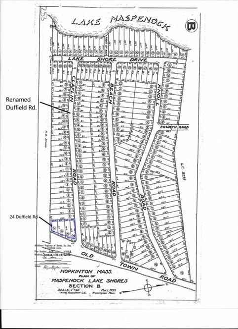
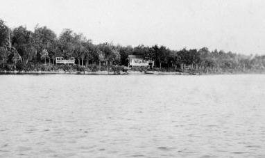
Camp Street
Camp Street Extension- Milford MA
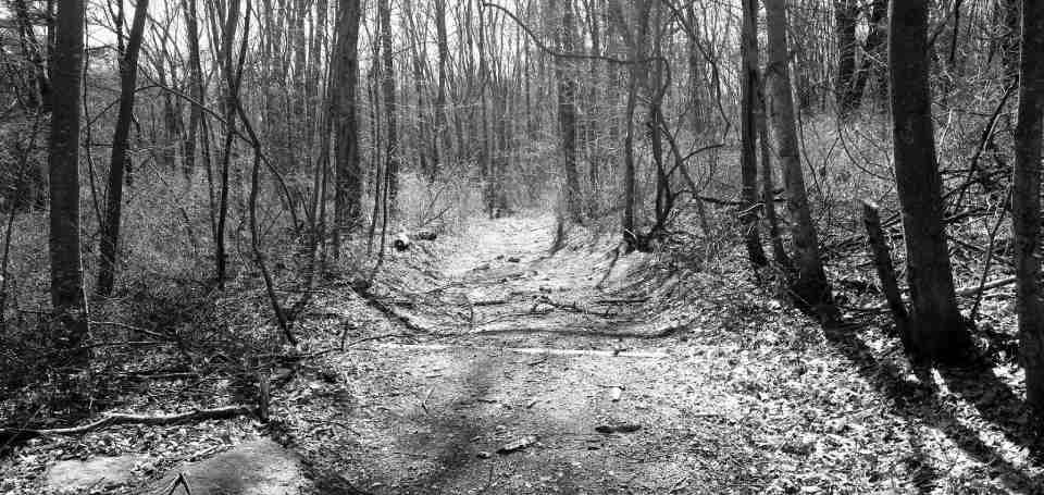
It is not very hard to imagine what Camp Street would have looked like in the late 1700's. The very western portion of Camp Street remains much as it was back then and is now preserved for perpetuity as Milford and Upton Conservation land. This old Camp Street extension runs to the Mill River at the town line in Upton. Once crossing the Mill River the road is called Taft St. in Upton.

Google Earth Imagery Date 10/2019
This portion of road was originally owned by the Taft family of Upton and this is where some of Upton's oldest families settled. As shown above on the Plan of Upton made by Nahum W. Holbrook, dated 1831, The Taft's had a grain mill on their land. The 1798 map shows they retained an odd shaped piece of land west of Peppercorn Hill.

Google Earth Imagery Date 4/22/2018
Looking at it from the air it looks like this area, which I call the "Giants Footprint", once held water and the stream from that pond runs directly to the location of the Taft's grain Mill. A trail map of Peppercorn Hill done in the 1980's for an Eagle Scout project has marked an area which was supposedly a Nipmuc cranberry bog. I do not know how they came up with the locations that are marked as camps and bogs but when you look at it from the air, this looks to be an area that was seasonally flooded and bog like. Perhaps the Taft family inherited this bog from the native people and seeing it's value kept it aside from the Daniel Hunt land that surrounds it?

Google Earth Imagery Date 4/22/18
Adin Ballou's History of Milford details the history of Camp Street as follows:
"Camp St., from Purchase, next north above Haven, westward, crossing Reservoir to Upton line at Mill River; is an old road, first laid out by the selectmen of old Mendon to Reservoir St., or thereabouts, 2 rods wide built in 1754, and the westerly portion thereof by the same authority. Probably wholly or partly a proprietor's pathway, long prior; said westerly portion re laid, 2 rods wide, 1813, and the easterly portion improved thenceforth from time to time ; the whole being about 450 rods long and 2 wide ; contents, 2 acres 130 rods".

Camp Street Milford MA 1851
Camp Street begins at Purchase Street where at one time an entire little village center existed. This little village of "North Purchase" was named for the purchase of additional land from the Nipmuc by the Town of Mendon in 1691. This additional three square miles was purchased for three pounds of silver and became known as the "North Purchase", being north of the original laying-out of Mendon. The cart path leading to the area became known as Purchase Street.
Google Street View Imagery Date 4/22/18
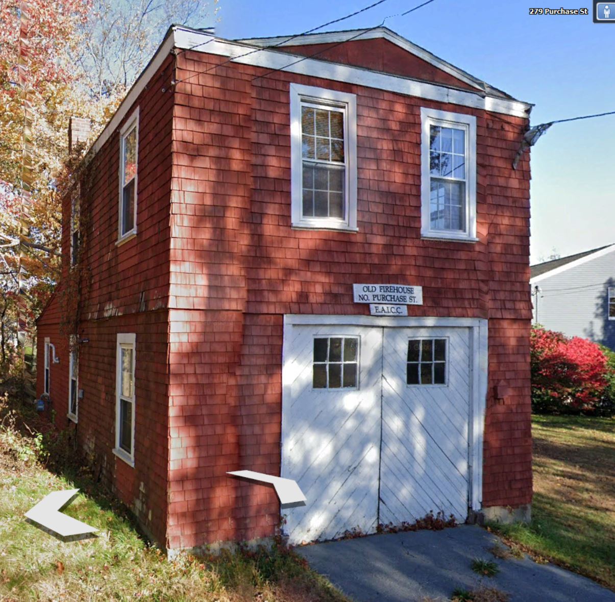
At the intersection of Camp Street and Purchase Street lived a man named John Cheney who's beautiful brick mansion house stands proudly today. Mr. Cheney donated land for a church and meeting house in North Purchase and was a large land holder elsewhere in the area. According to Ballou, "the old church was burnt by a parcel of rowdy lads out on a spree, Oct. 23, 1860". The church was then replaced with the old firehouse which stands there today
.
Google Earth Imagery Date 10/2019
Across the street from his brick house on the opposite side of Camp St. stood a bowling alley he operated.
As you can see from the map above, the Ball's were another important family on Purchase Street with Josiah Ball being the second settler here. His family lived on Purchase St. and operated stores and boot shops there as well.

Homer Ball Store Today-Google Earth Imagery Date 10/2019
The Ball family paid for and built the schoolhouse in the village, old #9 school.

Google Earth Imagery Date 10/2019
His daughter Rachel and her husband John Desper owned the last farm in Hopkinton on Old Town Road and moved there in 1809.
Reservoir Road

1798 Map of Upton/Google Earth Imagery Date 4/22/2018
Off of Camp Street in Milford, at Reservoir, the Hunt family owned farm land and operated mills in an area that long ago was called "Bungay". This referred to the swampy lands south of Lake Maspenock and may have received that name from the English settlers who first came here. According to wikipedia, "The origin of the name of Bungay is thought to derive from the Anglo-Saxon title Bunincga-haye, signifying the land belonging to the tribe of Bonna, a Saxon chieftain. Due to its high position, protected by the River Waveney and marshes, the site was in a good defensive position and attracted settlers from early times."
According to Ballou's History of Milford, "two small manufactories of cotton and woolen goods had been started in town: one in Bungay, so called by Ebenezer Hunt as early, perhaps, as 1827 ; and the other, not long after, in the Centre, by Stephen R. and Parmenas P. Parkhurst. These had a run of several years in both places, but were doomed to extinction. Pecuniary losses, fires, etc., desolated them".
In 1842 Lyman P. Lowe's factory in Bungay burned listed as "still desolate". So it looks like the Hunt factory ran from 1827 and at some point was sold to Lyman Lowe. It burned down in 1842 and was left desolate.
One reference I could find about the Hunt mills is in Ballou's history of Milford and talks about a man named John Schofield, born Dec. 15, 1793, listed as a woolen-factory operative and overseer."Mr. Schofield came over from England at 20 years old. He was long an operative and overseer in woolen factories, but later betook himself to boot making. He dwelt at Bungay at one time, when the woolen manufacture was carried on there; and one, at least, of his younger children were born there. He was an ingenious, industrious, honest, and kind-hearted man in his own somewhat peculiar way."
From the book Upton Massachusetts 1735-1935 P.33 we find some information:
"Before the town was incorporated many homes spun and wove cloth. Mothers, daughters and children engaged in these home arts which were necessities. So when Ebenezer Hunt set up his two sets of machinery and a dye house at the foot of the pond, he was changing the habits of many homes but giving steady employment to a considerable corps of workers, and bringing cash into circulation and benefiting the town. The yearly output was 31,200 yards of cloth valued at $15600 in 1837. The burning of the mill in 1843, during the unrest of Dorr's Rebellion in Rhode Island ended the weaving industry in town."
As we can see on this 1827 map of Milford, the Hunt mills on Reservoir Road and Aaron Partridge next door on Camp Street. From Adin Ballou's History of Milford P.952
"Aaron Partridge was born in 1774 and purchased the old Cody place in Milford on Camp Street near Bungay in 1799"
From the same book we find this passage: "Joseph Cody was from Hopkinton, the son of Isaac and Hannah Cody, born May 2, 1736. He settled in the vicinity of Bungay around 1760 on what has been in our time called the Partridge place". This family remained in town some little time after its incorporation. I think he was its first constable, and was styled "Lieut. Joseph Cody." He was a carpenter; and tradition says that he seldom used any measuring implement, but laid out his framing work so accurate by eye that all his joints and mortises fitted exactly when his frames were raised. He probably moved from town, perhaps to Hopkinton not long after its incorporation. I cannot trace him further."
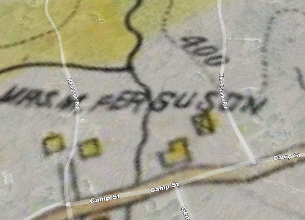
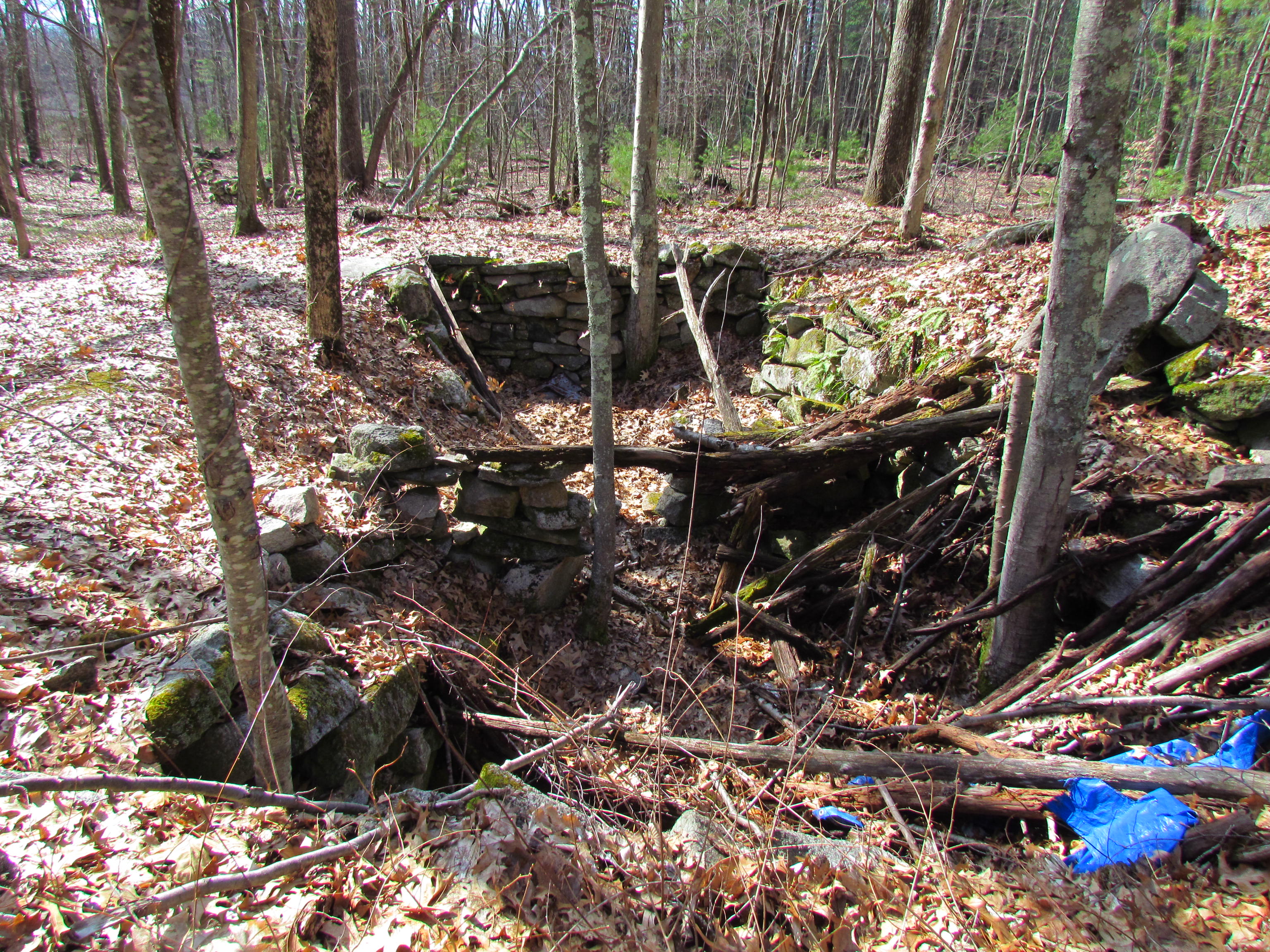
So from all this we can deduce that Camp Street was a cart road that was widened and improved about 1756 and four years later, Joseph Cody settled on the land. 40 years later in 1799, the land was purchased by Aaron Partridge. This area, now under the high tension wires, remained farm land, passing hands several times through the generations eventually belonging to a lady named Mary Ferguson. Pine Island Road is recorded as passing through the Ferguson land in 1901. The old cellar holes of the farm buildings can still be seen under the wires, but the old swamp they used to call Bungay has swallowed it up in a tangled mess.
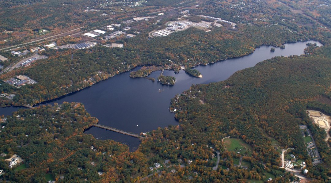
Maspenock Dams
Maspenock Dam
The first Lake Maspenock dams were probably built by beavers. After settlement of the area, the beaver dams would have been reconstructed by men using wood and earthen structure to create a more stable dam and higher pond than what was there naturally. The pond at the time of English settlement was about 56 acres. In the 1830's, with many industries dependent upon the Mill River, plans were made to create a bigger pond.
In researching property records and land documents for Pine Island Road, the first recorded land transaction on the south eastern shoreline is between Clark Fisk and John Parkhurst in 1833. This land included what is now Pine Island Road and Piney Island before it was an island. This is the same Fisk family with the first mill privilege downstream. In the early 1830s, much land was sold in and around the area of the dam and north of the dam on the lands that were to be flooded. One of the men purchasing land was Aaron Claflin

Aaron Claflin was a wealthy boot and shoe manufacturer originally from Milford who had moved to New York to operate a dry goods business. He had purchased several tracts of land around the lake and dam in the 1860-70s from men with the names Ball, Wood, Parkhurst and Eames. As a matter of fact upon his death his obituary mentioned that he was the largest land owner in Milford. After his death, his son Charles F. Claflin became one of the founders of the Milford Water Company, which for many years controlled and operated the Maspenock dam.
In the beginning of the 1830's nine owners of mills incorporated themselves to raise the lake to provide a greater headwater for their mills downstream. Records dated October 16, 1833 found at the Worcester Registry of deeds, reveal that at that time, nine owners of mills starting at a privilege just below the dam and running down Mill river to Woonsocket, RI where Mill River joins the Blackstone River, associated themselves "for the purpose of constructing and maintaining a reservoir to raise and preserve a head of water to serve the mills on the Mill River " during dry periods.
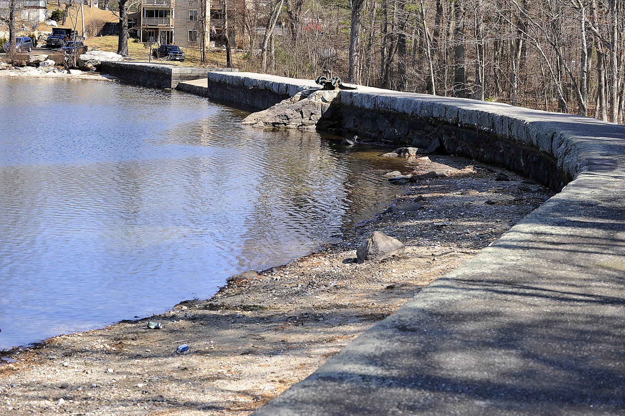
According to the document, these individuals had expended $2,100 in the purchase of the right and privilege of flowing certain lands in and about the reservoir and in the construction of a dam. This dam is was located about 150 feet south of where the first dam had been constructed.[15] In the image below you can see the approximate location of the original pond shoreline and dam. Note how Spindel's Island was a peninsula and the lake was very narrow at the outlet.
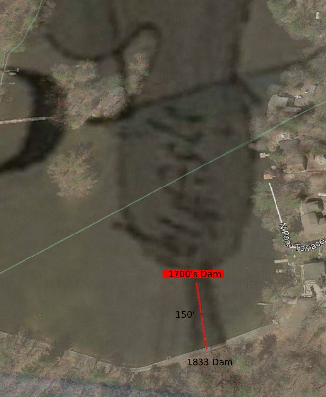
Location of original dam and shoreline - Google Earth Imagery Date 4/22/2018
When this new dam was completed the pond was transformed. What was a pond of about 56 acres was now 215 acres. As you can see from the overlay image below, the shoreline was changed dramatically. The very narrow outlet of the lake was flooded and the peninsula at the end of the old dam became an island, now called Spindel's Island. The shoreline was flooded and expanded in some areas between 40 to 80 ft from the original shoreline.

Animation of 56 acre pond becoming 215 acre lake in 1833
This created coves where there once were none and turned the large eastern peninsula into 2 small islands. 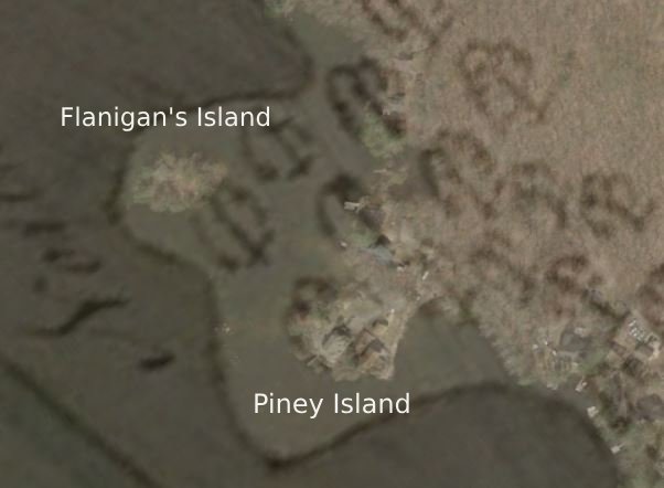
Piney Island Hopkinton 1831/Google Earth Imagery Date 4/22/2018
One is Piney Island and the other was connected to the shore in the early 1900's and now has two houses on it on Pine Island Road.
Where the old pond ended near Amherst Road, the new lake flooded the stream bed and swamps all the way to the town road. This left 3 more islands where the land was highest. Sandy Island, Woody Island and Twin Island were born. Later they would also be connected to the shoreline by fill and roads.

Sandy, Woody and Twin Islands - Google Earth Imagery Date 4/22/2018
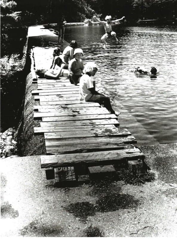
Past lake residents recalled that during the 1920's when Sandy Island was an island, they would swim from the beach to the island carrying their clothes on their heads. It is believed that at one time, a small well located near Sandy Island, furnished water to a number of homes at the lake.

Sandy Island 1920's
During the early 1850's, some inhabitants of the town were displeased with the raising of the water level which flooded the town roadway. Proprietors of the North Pond Reservoir were successful in a law suit to prevent the objectors from lowering the height of the water. This resulted in the town selling flowage rights over the way to the proprietors for $1,200
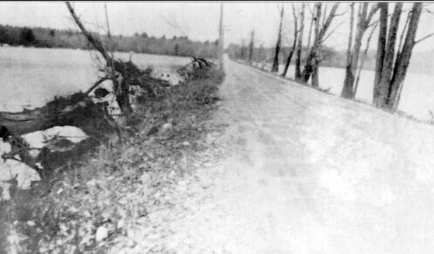
West Main St. 1938
Around 1890, the dam was found to be unsafe and the gates were left open for the next decade.
Around 1900, it was decided to repair the dam and construction work was completed during 1901. Costs of the work were met by contributions from the Lonsdale Co., Manville, Co., Lawton Spinning Co. and the Draper Corp. Smaller contributions were received from a few companies below Woonsocket. The Milford dam was maintained for many years for power, water and as a means of reducing the possibility of floods. If you wish to read more about the Mill River and the history of the dams downstream click here.
In the early 2000's the Milford Water Company began to balk at maintaining the dam at their cost and began to look for a private buyer. This was of great concern to residents and members of the Lake Maspenock Preservation Association which worked tirelessly to bring a vote to Hopkinton Town Meeting. With great support from members of the lake association and the people of Hopkinton, an article to buy the dam was presented at the town meeting in 2006 and was voted yes overwhelmingly.
After a series of delays that put off finalizing the purchase, the deal was finally signed in April 2007 and the Town of Hopkinton has been responsible for the operation and maintenance since that time. The town has worked with state and federal representatives to receive grants and funding for repairs and for a new gate system that was installed in 2019.
Work continues on the dam today under the direction of the Town of Hopkinton.
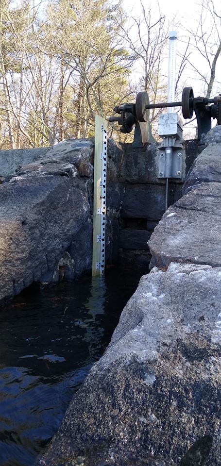
At the present time recreational use of the lake is threatened by invasive weeds which have been a growing problem over the last couple of decades. The town is presently debating using herbicides in the most weedy areas of the lake. This has met some opposition by citizens of Hopkinton and the permit to utilize herbicides has not yet been received. The town also utilizes periodic extended draw downs to expose the weed bed to extreme cold and reduce them naturally that way. This has had some limited success but is reliant upon the weather.

Extended drawdown photo courtesy of Abbie Haus January 18, 2021
At Town Meeting in May, 2015, it was requested that a Town Weed Advisory Committee be formed to advise the Board of Selectmen about the growing weed problem on Lake Maspenock. The town has formed the Lake Maspenock Aquatic Vegetation Control & Management Advisory Group to research and develop additional approaches to combat the weeds. This group is currently meeting regularly. You can get more information from the lmpa web site.
Pine Island Road
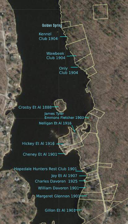
Photo Courtesy MA GIS
Pine Island Road spans the towns of Hopkinton and Milford along the south eastern shoreline of Lake Maspenock. Pine Island Road in Hopkinton was developed first and has a unique and interesting history. First, you can not get to Pine Island Road from Hopkinton proper by car without going through the town of Milford. Not only does Pine Island Road span two towns, you also cross from Worcester County into Middlesex County each time you pass.
In researching property records and land documents for Pine Island Road, I found the first recorded land transaction for the land on the south eastern shoreline. In 1833 Clark Fisk sold a large tract of land to John Parkhurst. This land included what is now Pine Island Road and Piney Island before it was an island.
Mr. Parhurst sold most of his land to Aaron Claflin when he was buying up land to be flooded by the higher dam. When the lake was raised, all that was left of the eastern peninsula of land the Parkhurst family owned was now an small island.
Eastern Peninsula Transformed Into Islands
The new Piney Island remained the property of the Parkhurst family until 1849 when Lucy Parkhurst and others sold the island land to Justin Eames. Aaron Claflin acquired it from Aemes sometime between 1849 and 1888 at which time he sold it to the men who would build the very first clubhouse on the lake.

In 1888, Herman Crosby, Addison Tyler, Emmons Fletcher, Fred Gibson, and Clarence Gordon, all of Milford, became the owners of the first club camp on Lake Maspenock. It was located on Piney Island.
Unfortunately for Crosby and his crew on Piney Island, two years later the dam was found to be unsafe and the gates left open for the next 10 years.
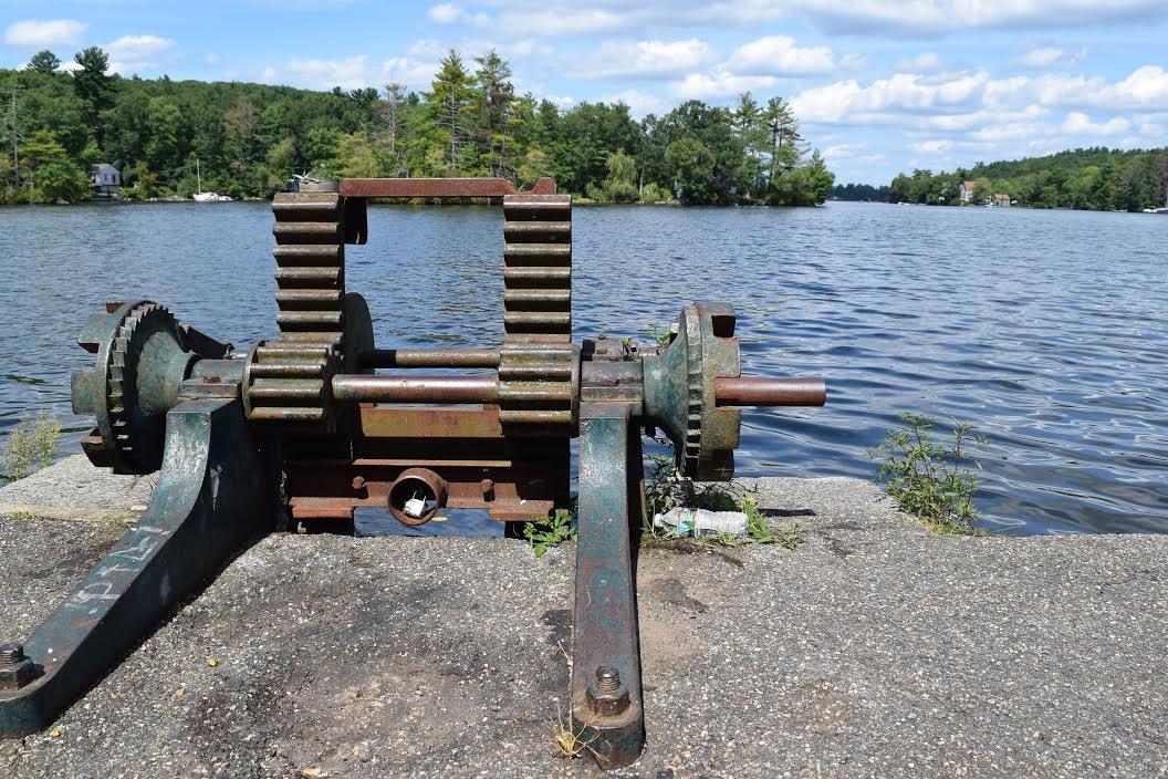
1901 Dam Gate
In 1901, with the dam now repaired, Charles F Claflin, one of the founders of the Milford Water Company and son of Aaron Claflin, combined and sold several tracts of land that his father had purchased to a man named Andrew T Macuen. Mr. Macuen was previously the proprietor of a cigar and ice cream shop in downtown Milford. Fun fact, Milford at one time was a major producer of cigars. 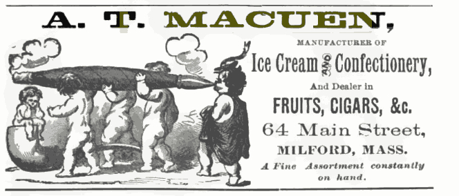
As it turns out Mr. Macuen's shop burned down in 1890 and ten years later it looks like he was in the real estate business. Immediately after purchasing the land from Charles Claflin in 1901, Macuen began sub-dividing lots and selling them. Almost all were sold to groups of men from Milford who cleared the lots and built small fishing and hunting cabins. Many of these were as small as 25 by 25. In 1903 two of the men that were part owners of Piney Island, Fletcher and Tyler, bought a piece of land across from the island from Andrew Macuen.

1903 Addison Tyler & Emmons Fletcher Cottage By the 1920's the Crosby club on Piney Island had many neighbors.
Unnamed clubs marked Et Al
How these lots were advertised is unknown but many of the names of the men on the deeds are also names we can find at Milford Water Company and Draper in Hopedale. The Joy brothers, who built the first Camp at 66 Pine Island Road, were sons of Moses Joy Jr. Founding President of the Milford Water Company who's company built the dam and water works at Echo Lake. The Joy Camp was a club from 1907 to 1960 and it was only expanded in 1988.

The Joy Camp, built in 1907 by Louis Joy, Irving Joy and Fred Boutwell
By the 1920's these camps dotted the eastern shoreline of the lake. On Pine Island Road and extending north were clubs called Hopedale Hunters Rest Club, Wawbeek Club, The Kennel Club and The Only Club and other clubs owned by multiple men who's club names were not recorded on the deeds.

Remains of The Wawbeek Club 2001
North Pond - the Boat Landing at Wawbeek Cottage Milford, Massachusetts 1911

The Hopedale Hunters Rest Club demolished in 2002.
Riding from Milford down Purchase Street and onto old Camp Street with their horse teams, the men owning the fishing cabins would have approached land owned by a lady named Mary Ferguson.
Mary Ferguson Farm corner Camp St & Pine Island Road Milford 1872
Mrs. Ferguson owned a farm house which cellar hole now lies under the power lines at the intersection of Camp Street and Pine Island Road. All the deeds for Hopkinton residents of Pine Island Road still include "a right of way over Piney Island Cart Path through land of Ferguson to Camp Street in Milford" this deed notation carries on all the way from Claflin in 1833!
Geri Rogers writes about the trip on the cart road and what life was like on Pine Island Road back in the early 1900's. Geri's family owned the tiny cottage still standing on the Snow property.
In her memoir, "North Pond Memories"she writes:
"The dirt road that leads to the pond kept all but the worthy at bay. A car, attempting to pass the test, bumped cautiously along in a vain effort to avoid the boulders left by retreating glaciers. The road was barely passable by horse-drawn cart, much less an automobile. All along its dusty way, woods hid any sight of the pond, until, at a sudden turning, sparkling blue waters leapt into view behind a curtain of shimmering leaves. This first sight of the water always caused a tingling sensation in the pit of my stomach and filled me with awe". For a wonderful look at life on the lake back then you can read Geri's full article here.
In 1930 a plan called Pine Ridge Shores was completed but never registered that would have extended Pine Island Road to the Wawbeek, Kennel and Only Clubs but the extension of Pine Island Road never happened and for many years access to the lots was gained from Old Town Road. Several of the lots were taken for taxes in the 30's and auctioned. The deeds for these lots still hold a right of way to Pine Island Road and every deed holder on Pine Island Road still has a right of way to the spring behind the old Kennel Club which was once called "Golden Spring". The deed specifies they can "take water from the spring by dipping with pails or glasses but not otherwise".
This clause in the deeds goes all the way back to Andrew Macuen in 1901 as at that time there were no wells for these camps. Geri Rogers recalls the stream in her memoir as follows:
"A boat carried us diagonally across the lake to the bubbling spring where we scooped our buckets of drinking water. The spring was a refrigerator for those lucky ones who lived near it. Soft drinks and milk bottles sat cooling in the little cold stream that trickled from the spring into the lake. I was frequently elected to fetch the spring water. My mother feared boats, and for many years after I had become expert at rowing and swimming, she insisted that I row along the shore for this trip. I still recall the exhilarating experience of rowing, by myself, across the deep water to the spring."
Due to the fact that you needed to cross two streams that empty into the lake in this area, Pine Island Road stopped and never extended to these camps. It is a dead end to this day. The fishing and hunting clubs fell out of favor and taxes were not getting paid to the town. By the 1940's, deeds for Lakeshore Drive had stipulations that "under no circumstances is this property to be used for the purpose of occupancy of any social, fraternal or other organization, club or association." The old fishing shacks have rotted into the ground or have met the wrecking ball. Some were expanded upon and turned into year round homes.

William Davoren House 1901 demolished in 2020
The old William Davoren house built in 1900 was torn down in 2020 It was the first home to receive electricity on the Hopkinton side of Pine Island Road.

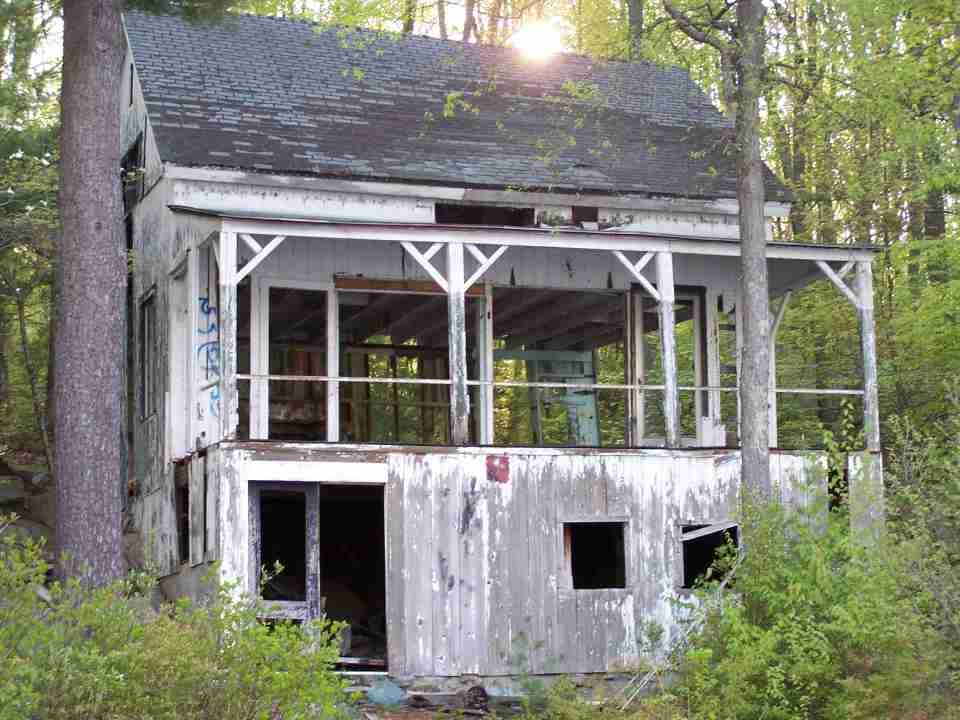
Gillon Et al Camp 1900
Another remaining original house is the Gillon house built in 1901.
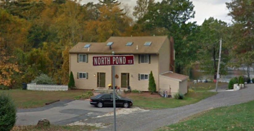
North Pond Terrace
Pine Island Road in Milford was developed by Henry Gaskill's Homeward Land Company in 1917. In a plan called North Pond Terrace, these lots were developed and sold beginning the 1920's. Small cottages were built along the shoreline during the years that followed.
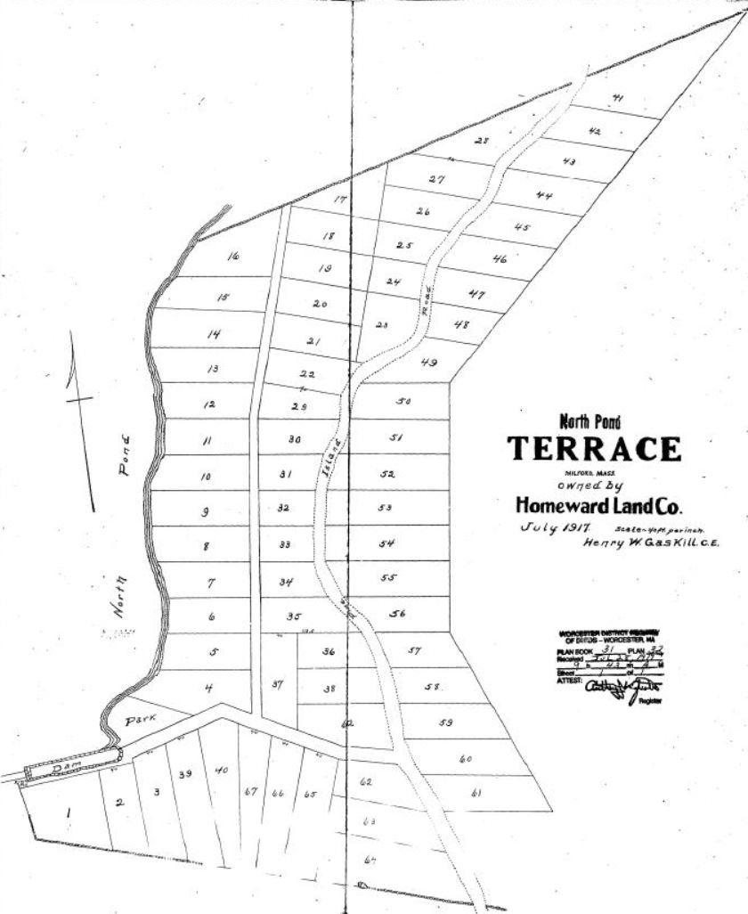
Plan of North Pond Terrace- Homeward Land Company Milford MA 1917
Matty's Casablanca and the New England Mob

By far the most interesting place on North Pond Terrace was a small tavern called Matty's Casablanca and it's connection to the Providence Mob. Just before the start of prohibition two separate crime families had emerged in New England. The first was founded in 1916 by Gaspare Messina and was based in Boston.
The other, based in Providence, Rhode Island, was started in 1917 by Frank Morelli. By the time prohibition was enacted, Frank Morelli controlled all the bootlegging and illegal gambling operations not only in Providence but also in Worcester Mass. Milford Massachusetts and the surrounding area was part of Morelli's turf.

Frank Morelli Photo courtesy of mafiahistory.us/
The years of Prohibition were a crazy time for the country. Although the passage of the 18th Amendment had outlawed the sale of intoxicating liquors, people continued to drink them anyway. The alcoholic beverage industry simply went underground. When breweries and distilleries closed down, people began making their booze at home or setting up stills in secret locations. When the bars and taverns closed, they were replaced by speakeasies and clubs. Morelli made sure he received his cut.
.jpg)
Speakeasy Photo courtesy Truckee Donner Historical Society
As detailed in the Pine Island Road chapter, some of the fishing and hunting camps dotting the shoreline in the area of Pine Island Road in Milford and Hopkinton Massachusetts were owned by groups of Italian immigrants who worked in the Milford Pink Granite quarries. These camps were away from town and only accessed by a narrow dirt road that was hardly passable for a team of horses and a cart much less an automobile. This was the perfect spot for stills, clubs, and speakeasies. Rumors and stories abound about the old cottages being used for brewing, speakeasies, and even brothels during prohibition. Although no documentation specific to the camps exist, there is a record of a still being raided close by on Purchase Street that gives us an idea about the lengths people went to hide their distilleries.
According to a September 6th, 1930 Boston Herald article, "Federal Agents from Boston carried out several raids in the town of Milford, Massachusetts, and arrested three men, including Peter Consigli, for the manufacture of liquor."
The Milford Daily had further details about the arrest in a newspaper article titled "Federal Agents Seize Big Still on Purchase Street," which reported that five federal agents arrived at the Consigli residence on the morning of September 4th and entered a barn located on the property. The agents had been informed that a still was kept there, so they waited in the barn in an attempt to catch someone in the act of operating the still. No one entered the barn, so the agents decided to seize the still and other equipment.
According to the article, the still was "the most unique construction of any ever located throughout the state, according to the police. It was found in a separate compartment in the barn and connected with a chimney in the house, therefore preventing tracing through any odor or smoke. The door of the barn had always remained open, which prevented any suspicion".

Police raid an illegal liquor still. Courtesy of John Binder, private collection.
In the September 5th, 1930 edition of the Milford Daily News, it was reported that Peter and his wife were arraigned on charges of violating the 18th Amendment, which prohibited the production or sale of alcoholic beverages. The charges against Peter's wife were dismissed, but an article published in the November 26th, 1930 edition of the Milford Daily News reported that a federal grand jury in Boston returned 120 indictments, including one against Peter Consigli, for violation of the Prohibition Act.
In 1932, Frank Morelli merged his Providence family with the Boston family, which was now run by Filippo Buccola. Buccola had emerged as the boss of the Boston family after Gaspare Messina stepped down. This was the beginning of the crime syndicate that would run the New England area for decades. Buccola ruled as boss of the combined family from East Boston until 1952 when he held a party in Johnston, Rhode Island, to celebrate his retirement and Raymond Patriarca's ascension to boss of the family.

Raymond Patriarca Photo Wikipedia
Patriarca's reach into the Worcester Massachusetts area included the bars, taverns, pool halls, and other small businesses where he placed his coin-operated machines. These establishments also served as local "offices" and paid tribute back to Patriarca.
Allegedly, one of these establishments was Matty's Casablanca on the shores of North Pond and was owned by Matthew Iannitelli whose father bought the first of four plots of land by the dam on North Pond in 1930. Rumors and stories abound about Matty's Casablanca and for many years it was a popular tavern in Milford and on Lake Maspenock.
One local resident, who as a teenager lived on Pine Island Road and used to do errands for Matthew Iannitelli, remembers a day when Matty asked him to take a car into town to have it washed. When he arrived at the car wash he was questioned about where he got the "boss's car" and it was only then that he realized he was driving Raymond Patriarca's car. He said he was extra careful driving it back.
Other locals remember Matty's Casablanca as a place to moor their boat and have a cold beer. Children were left to their own entertainment, swimming at the dam or eating frozen Milky Way bars which Matty sold out of his place. Others remember being told as children to stay away from Matty's and its seedier clientele.
Site of Matty's Casablanca 2013
Matty's Casablanca closed down in the 70s and Matthew Iannitelli died of cancer in 1980. A simple duplex now stands where the Casablanca once served Milford, North Pond, and the New England Mob.
Crockett Road History
In 1972 a group of Crockett Road residents led by Francis Walleston built a coalition called Peppercorn Hill Association (PHA) to have better representation and unification of the neighborhood community. 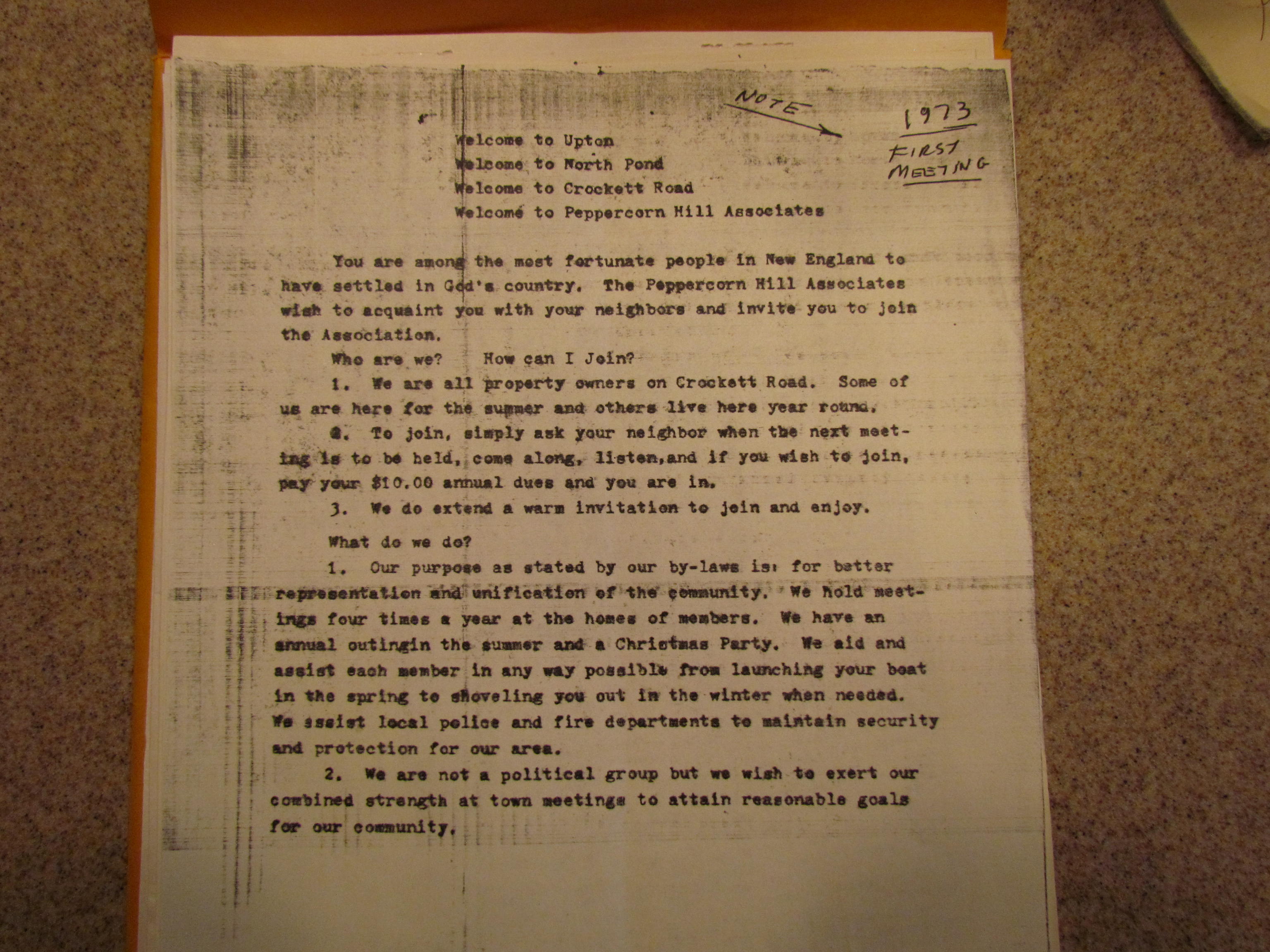
Before the association was formed, there had been a movement to make Lake Maspenock a watershed reservoir. People all around the lake became involved to the point of taking busloads of people to the state house to protest. This successful endeavor awakened lake residents to what they can accomplish when organized in support of or against any issue that may effect their homes and was the main impetus for the lake associations being formed.
When Crockett was a dirt road it was in constant need of work and PHA would petition the town for funds to fix the road as required. The town would appropriate funding for gravel and use Bob Spindel's steel grader which he would pull behind his truck to level out the gravel. Residents would then come out with shovels and do the finish work. At one stage the residents came out with saws and axes to cut trees and help the town widen the road.
Years later PHA worked to convince Milford and Upton to put in a new bridge and culvert and straighten the road in the area. One major reason was fire protection. Milford and Upton had a mutual agreement that in the event of a fire on Crockett, Milford would respond first while Upton Volunteer FD mustered and took over. The old bridge was considered unsafe for Milford fire trucks and thus the new bridge and culvert were installed.
PHA also worked to change the status of Crockett Road to an accepted road making it eligible for all considerations to maintain a "safe and passable road". In 1981 the control gate on the dam failed and PHA worked with Milford, Upton and the Army Corp of Engineers to send divers to fix the gate at no cost. PHA also successfully worked to stop a 150' radio and TV tower with access roads on the top of Peppercorn Hill.
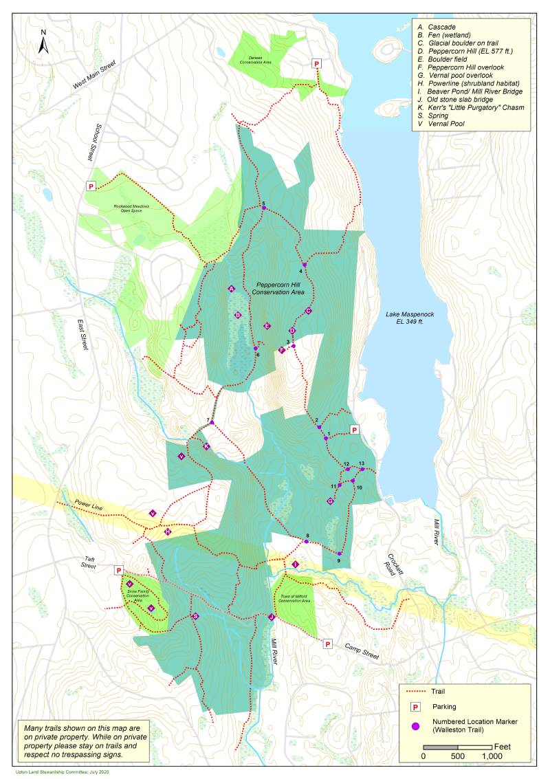
By far the most successful endeavor of the Peppercorn Hill Associates was the protection and conservation of Peppercorn Hill Conservation Area.
Peppercorn Hill Conservation Area
Francis Walleston, a member of Upton Conservation Commission and Peppercorn Hill Association learned during a con con meeting that the owner of the land on Peppercorn Hill were planning to sell it to a developer. Test borings had already been done and the plan was to build 90 homes. Due to it's agricultural tax status, the town of Upton was allowed 60 day right to purchase the land.
That night after the meeting, Mr. Walleston called his next door neighbor to tell him the area was going to be developed and the PHA formed a committee to stage a campaign to save the 270 acres.
During this time period, Marjorie Sanford, a Crockett Road resident and PHA member, was also treasurer of the Town of Medway. She became aware of a state program that was about to expire with still uncommitted funds available. The purpose of the program was to reimburse towns, 80% of the cost for purchases of land which would be devoted in perpetuity to recreational or conservation purposes. While it was known that the town had right of first refusal, it wasn't until the Peppercorn Hill Association presented this attractive financing possibility to the Town did the real possibility of making the purchase gain traction. Marjorie assisted with the necessary application paperwork until a state commitment was assured.

At the same time, Mr. Walleston's neighbor Don Kerr, was an engineer and had equipment for making flyers. The association went to work making flyers and with the help of Dick Smith and the Boy Scouts they went about handing them out in and around town, even sitting for hours at the gate of the Town Dump. The small town of Upton had never seen such a campaign and the effort led to a special town meeting to vote for the purchase of land.
On the night of town meeting, March 11, 1985, Mr. Walleston designated Don Kerr as spokesman and when they arrived they found themselves in front of almost four hundred citizens of Upton. Don looked over at Fran and said "let's go for it".
Fred Sanford, Marjorie's husband, and long time Crockett Road resident remembers Don's contribution.
"Don Kerr was nothing less than the heart, soul and energy of Peppercorn Hill Associates. In my fifty years at 43 Crockett Road, I know of nothing, civic or social, accomplished by the organization that was achieved without Don's support and enthusiasm. This especially includes the purchase of the hill. Don was a tall, good looking man gifted with a mellow low voice and a wonderful way of communicating that made him immediately liked and trusted, with good reason because he was, indeed, a man of high quality and trustworthiness. Don was fully engaged in the association's activity to promote the purchase of the hill including helping pitch the plan to the Conservation Committee, and facilitating production of some promotional material which was kindly supported by the Boy Scouts who distributed it.
However, Don's crowning moment was at the town meeting where the purchase was decided. Not being a voter in Upton, I sat in the visitors' gallery while Wally and Don were on the Town Meeting floor. His presentation on the town meeting floor was nothing short of a "Mr. Smith Goes to Washington" moment. The Town Meeting voted nearly unanimously to buy the hill, an extraordinary margin for any New England Town Meeting. Don was truly "the closer" for which he should be remembered and memorialized. Don and Wally are gone now and will be missed by all who love and enjoy North Pond, Crockett Road and the beautiful gift of Peppercorn Hill."
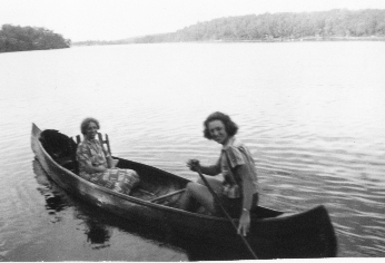
Don Kerr and sister Hazel- Top of Peppercorn Hill
In May, 2019, Bill McCormick, representing the Kelly family, informed the Upton Conservation Commission that the Kelly's would like to sell the land they own on Peppercorn Hill to the town. The land included four
parcels encompassing about 66.2 acres. The Conservation Commission voted to pursue the opportunity and obtained an appraisal for the property in August, 2019. The Upton Open Space Committee and Conservation Commission worked with the Sudbury
Valley Trustees (SVT) and Metacomet Land Trust (MLT) to develop a plan to acquire property. In 2020 Upton citizens voted to purchase and protect the Kelly land on Peppercorn.
Anyone that hikes the beautiful trails of Peppercorn Hill today owe a debt of gratitude to the Peppercorn Hill Association, Francis Walleston, Don Kerr, Marjorie Sanford and all the neighbors of Crockett Road who were able to organize and save the crown jewel in Upton's Conservation Land, Peppercorn Hill.
Photos from the Kerr family of Crockett Road.
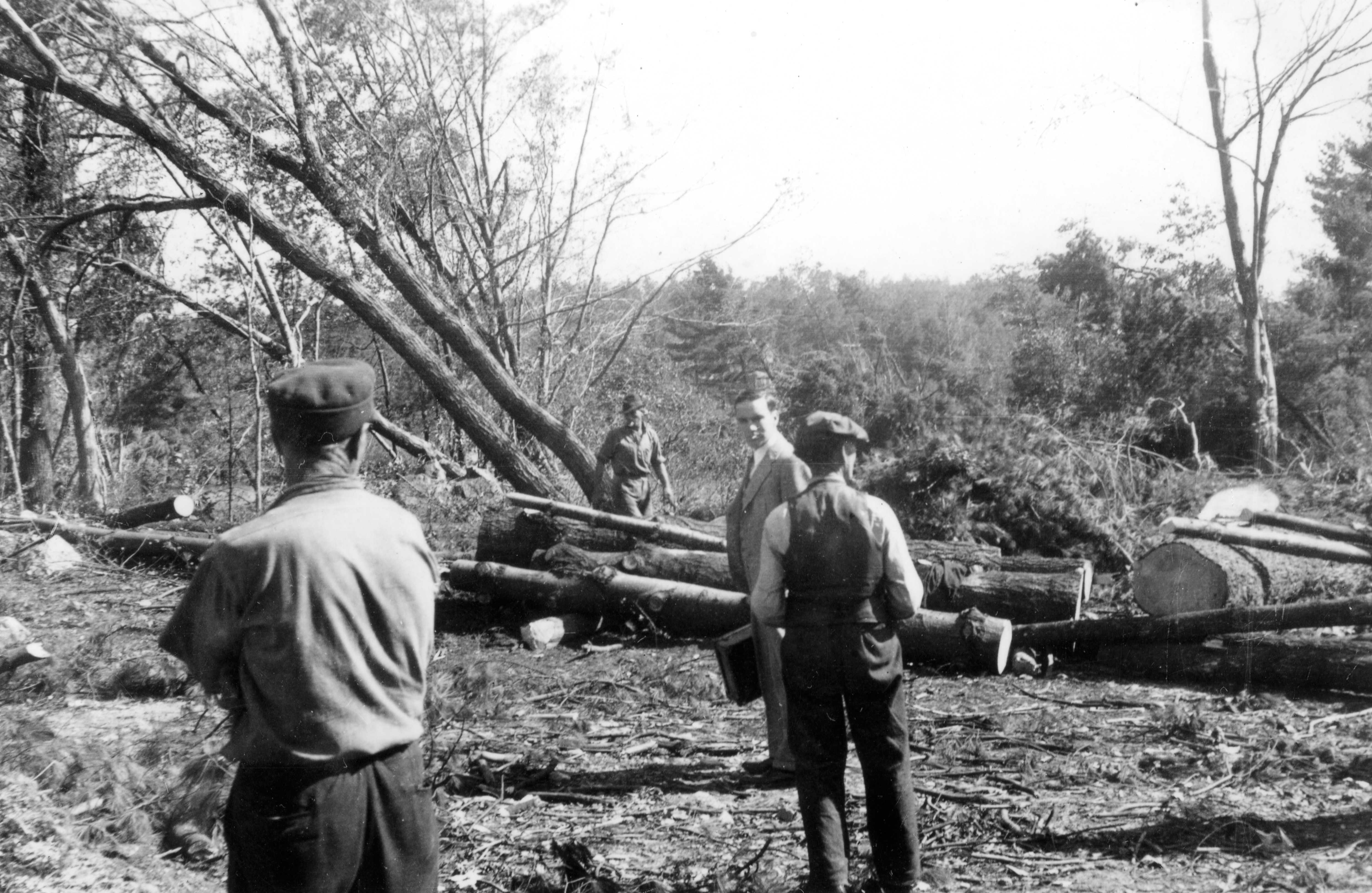
Logging Crew Peppercorn Hill 1930s
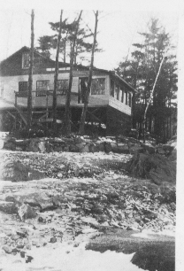
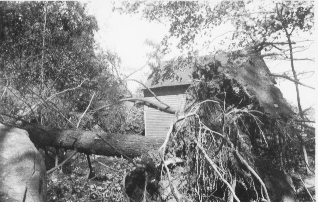
1938 Hurricane Damage
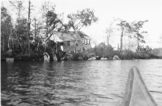
Spindel's Island 1938 Hurricane
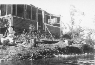
Benson Cottage 1938 Hurricane
Kerr 2

Kerr Family Car
Oakhurst Road

Oakhurst Road in Hopkinton has a rich history. The Deneen family purchased a large tract of land in ?
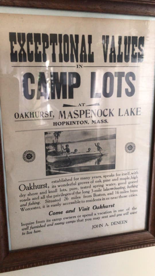
Oakhurst Road was developed in
Lakeshore Drive
Lakeshore Drive
![]() Mac's cabin was at the end of Hayward st right on the parking lot for Sandy Island (or Sandy Beach as it is known now). They sold groceries and through another entrance had a jukebox, pinball machines and a sort of soda fountain. Old time residents said that Mac's had a couple of great pinball machines and "the baseball machine would give you a shock if you were playing it in a wet bathing suit".
"They used to have talent shows in the parking lot on Friday nights"
The go to place for lake people.
Mac's cabin was at the end of Hayward st right on the parking lot for Sandy Island (or Sandy Beach as it is known now). They sold groceries and through another entrance had a jukebox, pinball machines and a sort of soda fountain. Old time residents said that Mac's had a couple of great pinball machines and "the baseball machine would give you a shock if you were playing it in a wet bathing suit".
"They used to have talent shows in the parking lot on Friday nights"
The go to place for lake people.
Downey Street

Historical Photos
Snow Family Photos

8-28-1924

Rogers Family 1918

Snow Family 1940

Looking North towards Piney Island 1935

Rowboat 1919
Photos from the Kerr family of Crockett Road.
Logging Crew Peppercorn Hill 1930s
Kerr Cottage 1938 Hurricane Damage
![]()
1938 Hurricane Damage
Spindel's Island 1938 Hurricane
Benson Cottage 1938 Hurricane
Kerr 2
Kerr Family Car
Don Kerr and sister Hazel- Top of Peppercorn Hill
Misc. Old Photos
![]()
![]()
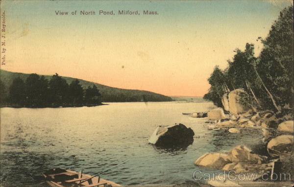
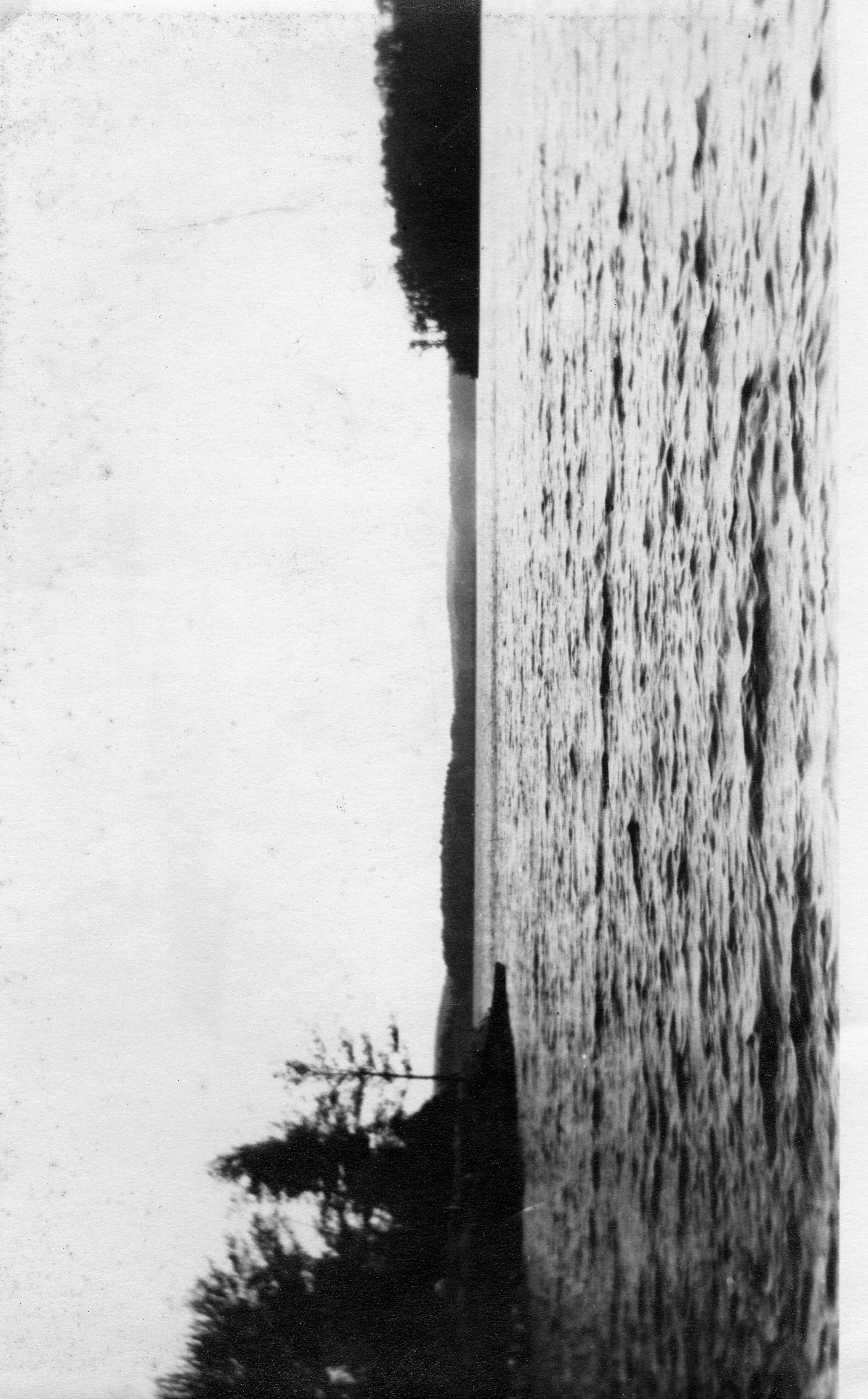
Postcard-View of North Pond 1908
1911 Postcard-View from Wawbeek Cottage
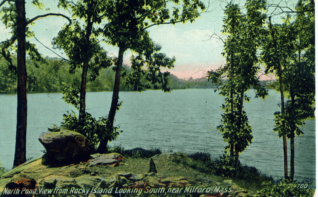
1913 Postcard-View from Rocky Island Looking South from Milford MA
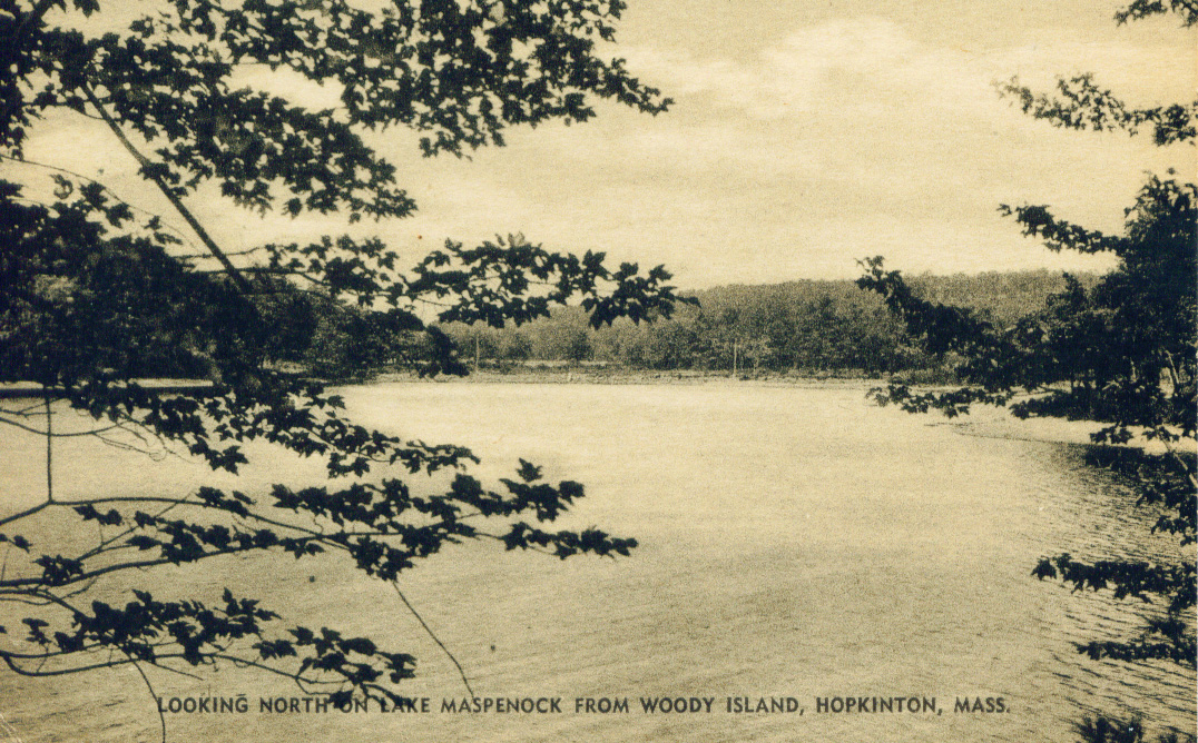
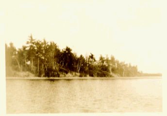
Postcard-Looking North From Woody Island
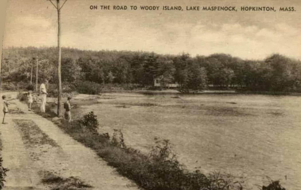
Postcard-The Road to Woody Island
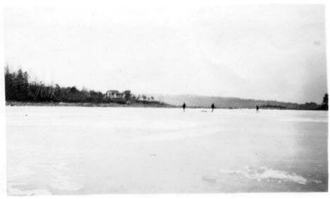
Sandy Beach
1935 Looking Towards Dam
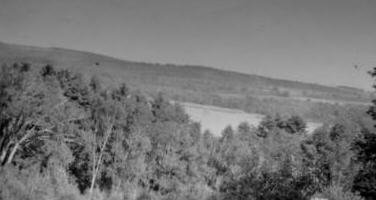
Top of Peppercorn Hill
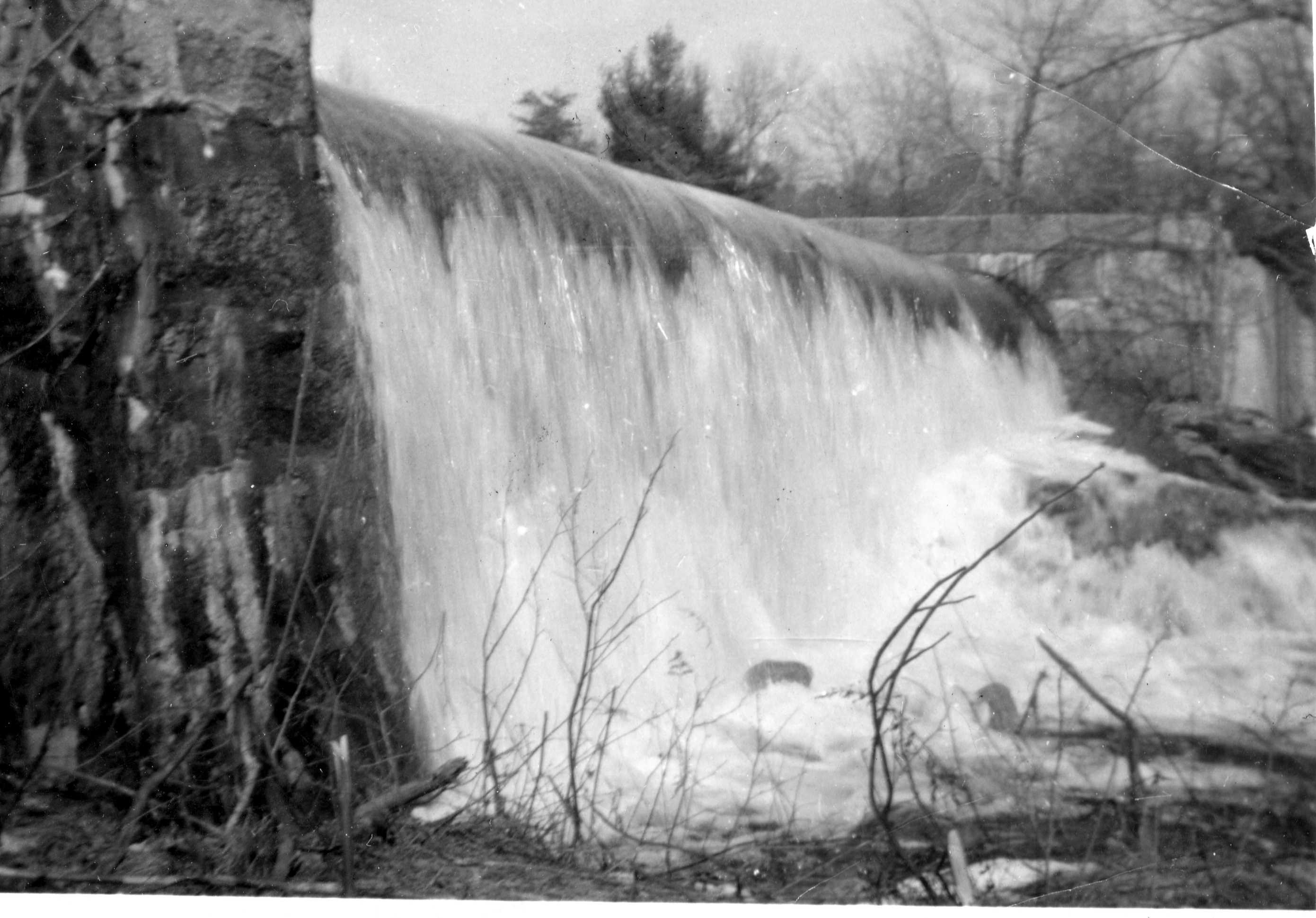
North Pond Spillway
Sandy Beach from Deneen Point
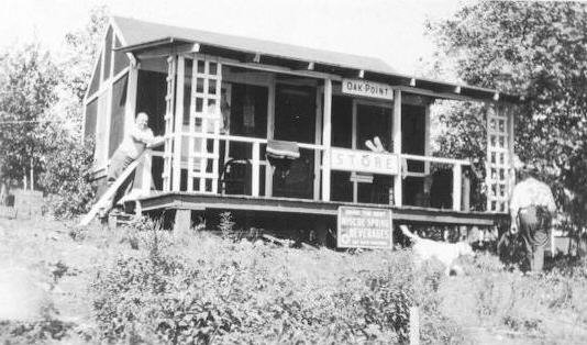
Deneen's Store
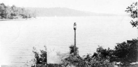
Deneen Point
Deneen Point
Carty Cottage
Dam 1970's
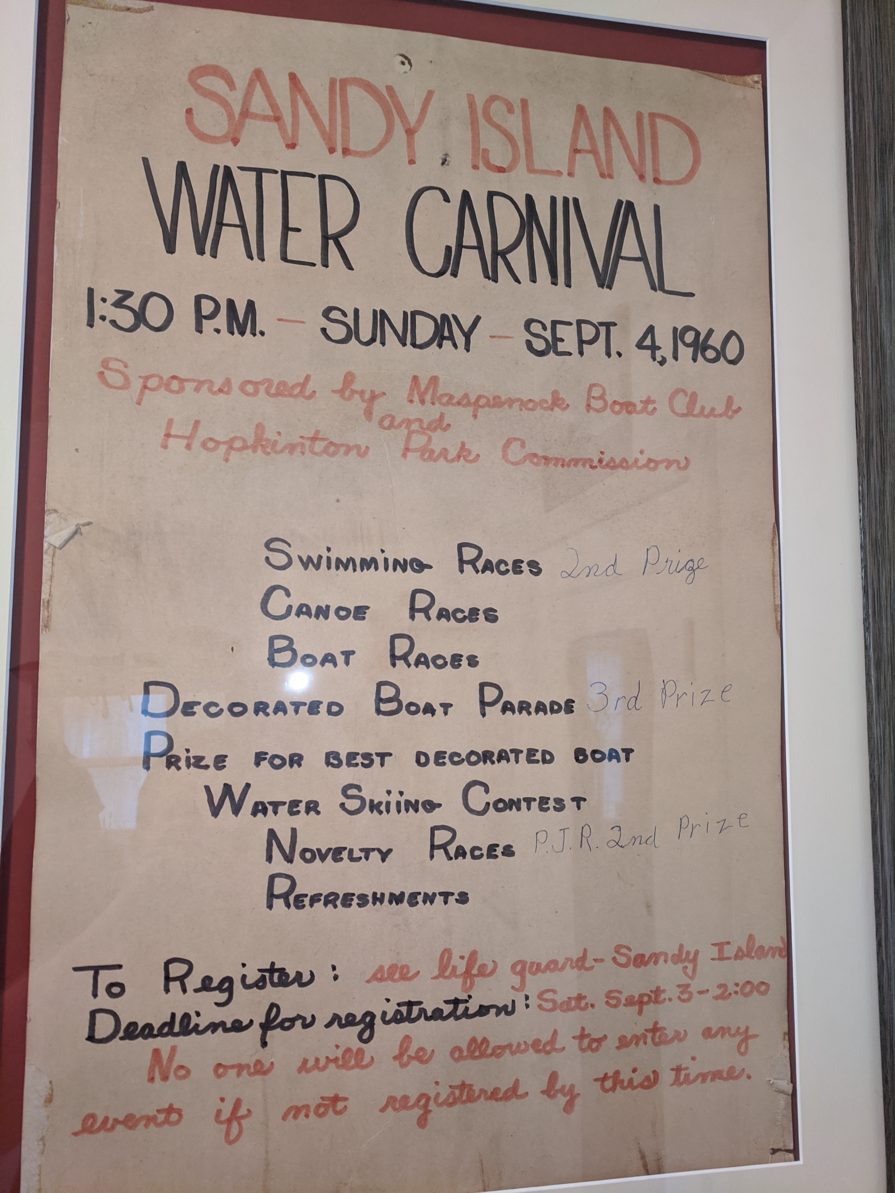
1960 Water Carnival Poster
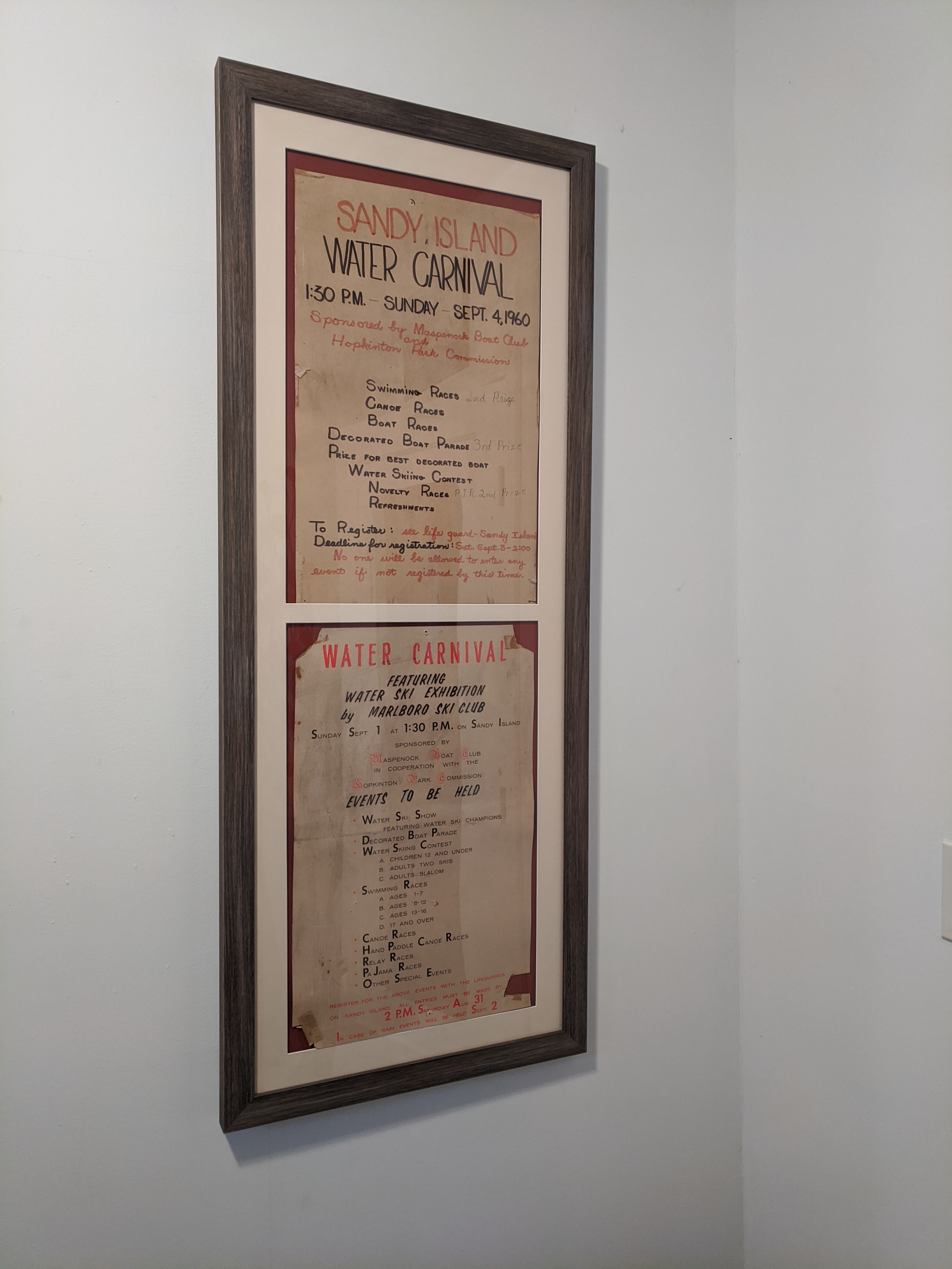
1960 Water Carnival Poster
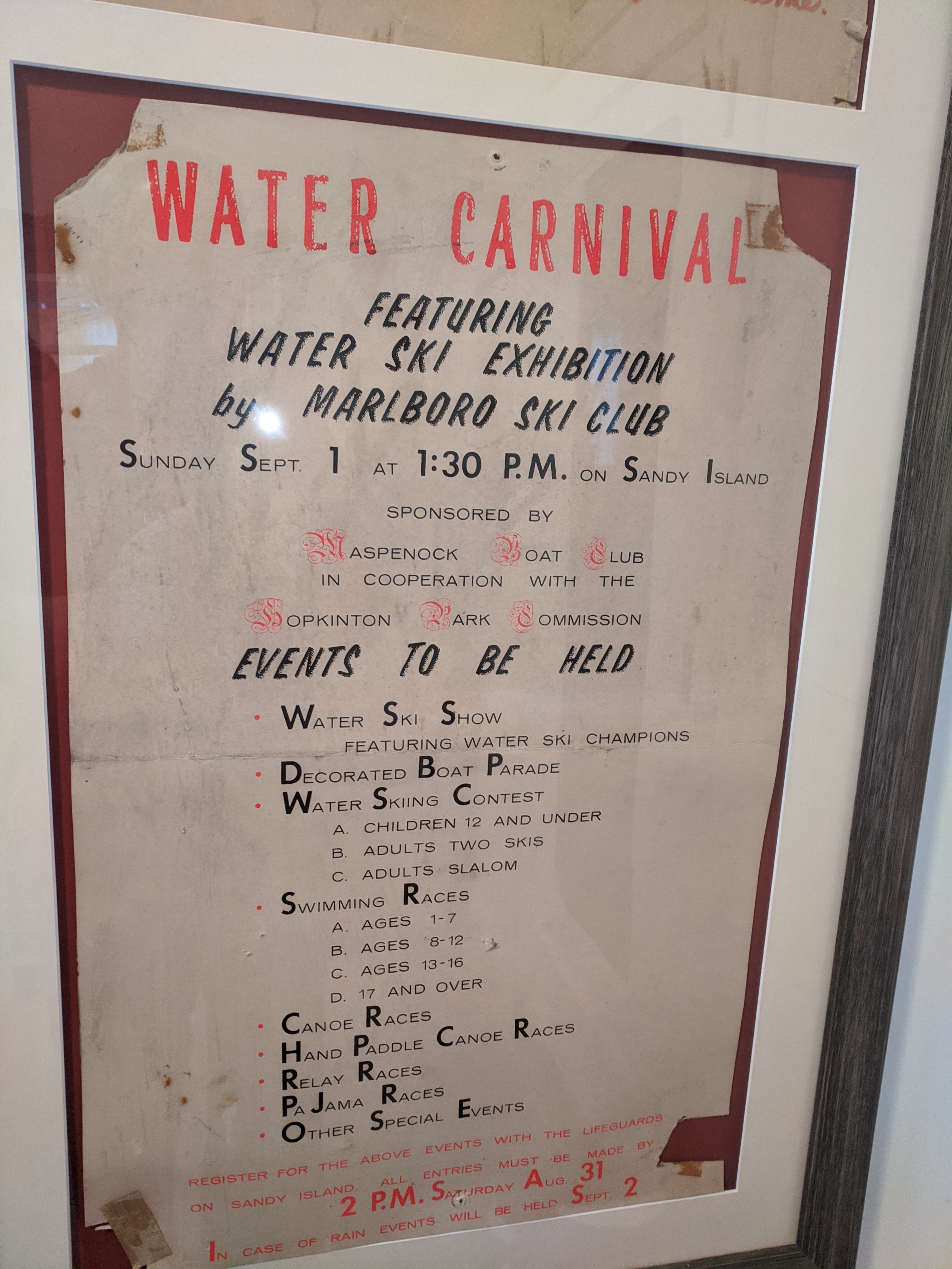
1960 Water Carnival Poster
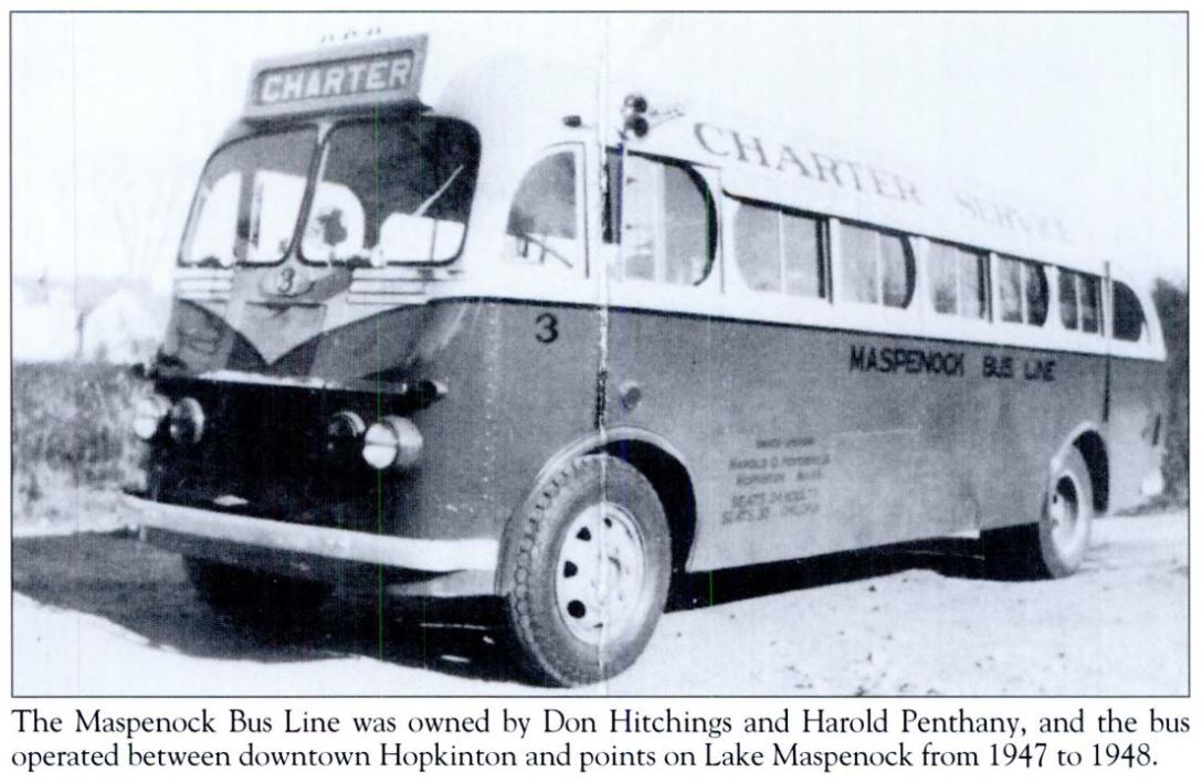
Maspenock Bus Line 1947-48
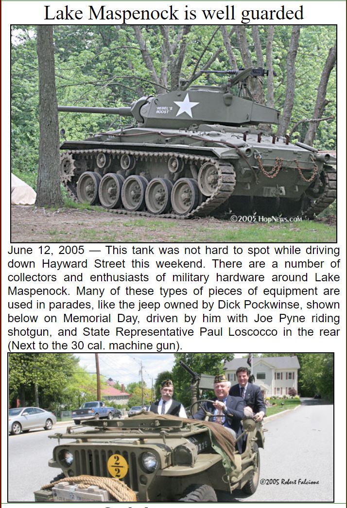
Maspenock Militia Tank 2005 by Robert Falcione HopNews.com
Milford Daily News Peppercorn Hill Check
Please contact me at @gmail.com to contribute photos to the project. I can collect them and return to you if they are not digitized.
Lake Maspenock Wildlife Photos
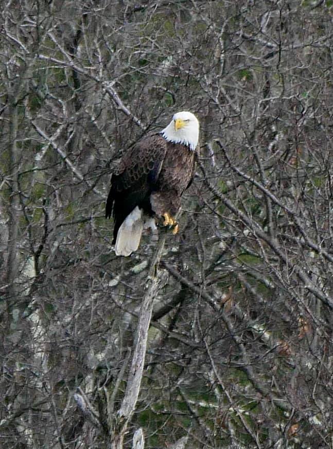
Bald Eagle
Bald Eagle
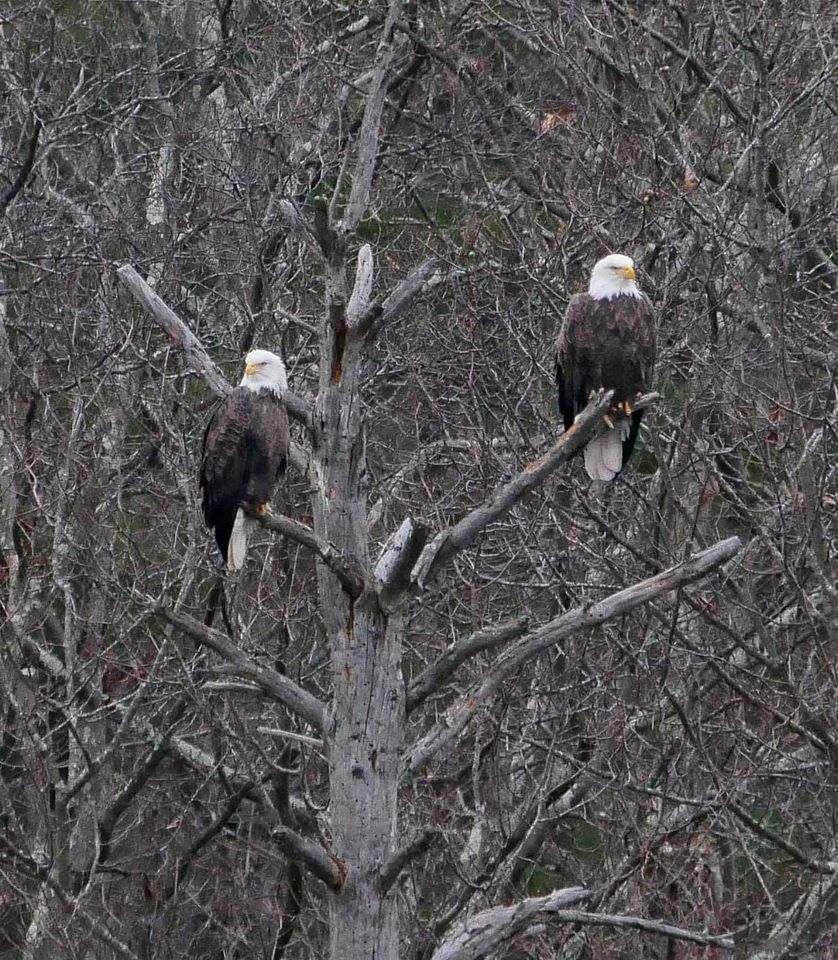
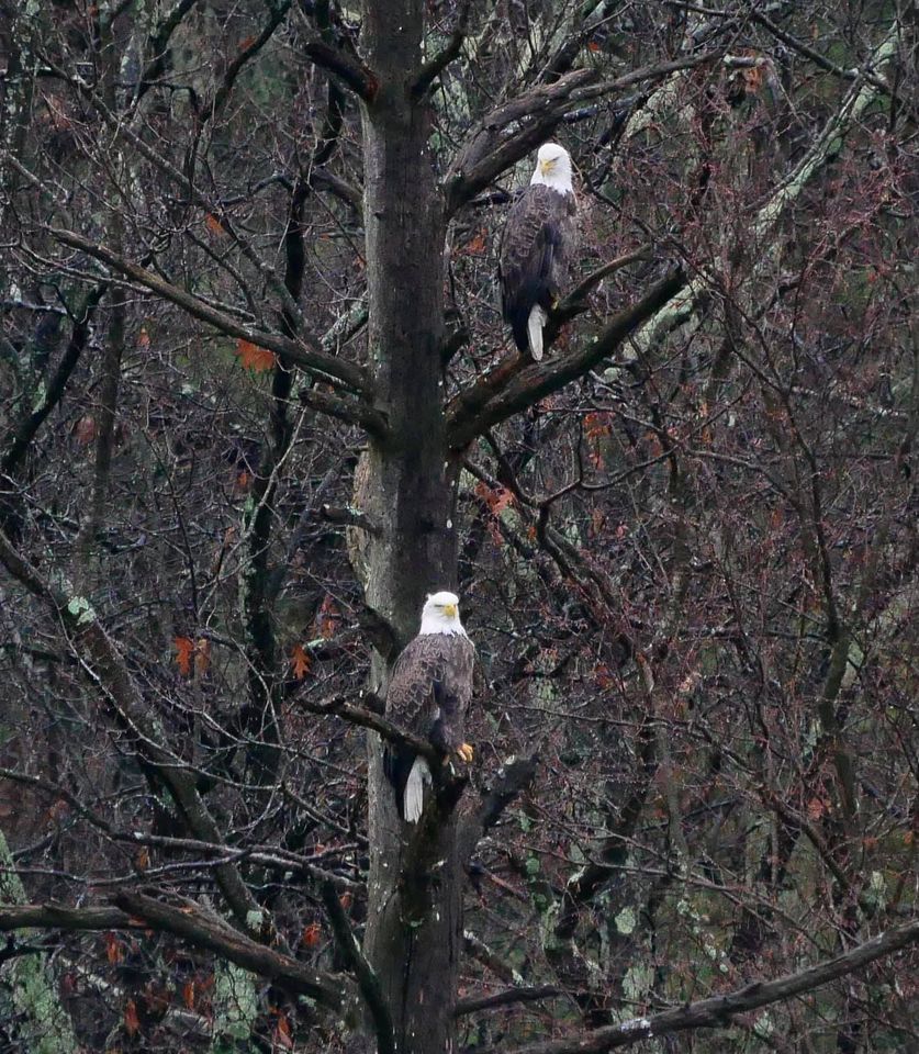
Bald Eagles
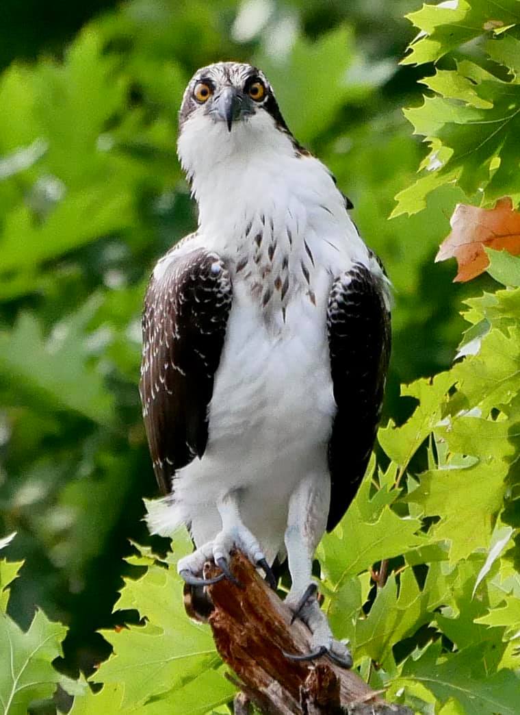
Osprey taken by MH Gibbs Upton
References
[1] The Proprietors' records of the town of Mendon, Massachusetts
[2] Hopkinton Historical Society
[3} EARLY MENDON & KING PHILIP'S WAR by Rev. Carlton Staples
[4} Plan of Hopkinton made by Matthew Metcalf, dated 1831
[5] 1732 Deed Brewer, William to Peter Ball and Josiah Ball
[6] Ball, Homer Tilton, Autograph manuscript letter to Rev Adin Ballou
[7] Josiah Ball family papers Hollis Library Harvard University
[8] Transcription of pp. 914-931 of Adin Ballou's History of Milford, 1882
[9] Deed Nelson, Seth of Milford to Zenas Ball 1809
[10] Article John Nelson The Worcester Society of Antiquity 1887
[11] Deed Ball, Zenas, to John Desper and Rachel Desper of Milford 1809
[12} Andrew Duno story, History of the town of Milford, by Ballou, Adin, 1882 p.549
[13} Deed Ball, Lazarus, to Josiah Ball, Estate bequeathed by Andrew Downer to my late father Josiah Ball
[14} Mill River Remains An Important Asset To Milford, Hopedale, By Gordon E. Hopper Milford Daily News, October 17, 1974
[15} Gordon E. Hopper, Milford Daily News March 11, 1987
https://www.jacobinmag.com/2018/06/factory-workers-strike-textile-mill-women
North Pond Memories by Geri Rogers Hussman
It lives within me as a source of joy. Memories are leaving me, so I must get these images down on paper before my vision of the pond dries up. I once read that, statistically, it is a body of water three and a half miles long and half a mile wide. It must be bigger than that! I always thought God created it. In the Beginning. The ghosts of little Indian girls accompanied me as I ran leaping over tree roots and stubbing little brown toes. They followed, forever, the same paths by the edge of the pond that I ran. I have learned that it was not Gods creation, but mans. There was a dam at the end to hold the water between the hills until the mills below had need of its power. I always knew of the existence of the dams, but still believed that it was God's pond.
I know not why this small body of water has always awakened in me such vibrant feelings. As an adult, I can equate my love of the lake with missing a lover. The dirt road that leads to the pond kept all but the worthy at bay. A car, attempting to pass the test, bumped cautiously along in a vain effort to avoid the boulders left by retreating glaciers. The road was barely passable by horse-drawn cart, much less an automobile. All along its dusty way, woods hid any sight of the pond, until, at a sudden turning, sparkling blue waters leapt into view behind a curtain of shimmering leaves. This first sight of the water always caused a tingling sensation in the pit of my stomach and filled me with awe. Ancient religions revealed their secrets after a similar trying passage. Only those who successfully experienced a holy initiation were allowed to know the mystical objects of the goddess. This revelation of the shimmering water was my initiation.
I must dredge my mind as they once dredged the pond after a drowning. I, too, may find a body or so. My first memories of the pond are buried so deeply that others stories must serve. I'd been born at the end of January, and my introduction to North Pond occurred some six months later. There are a few photographs; one shows a very plain baby and a little girl with cropped dark hair. They sit in the aft seat of a rowboat and the pond poses behind them. My love affair with the water and adoration of my sister began that early. My two older sisters, my brother, and I loved the pond. My brother described his feelings in one of his letters from army training camp, "Since coming down here to Texas I have come to regard the lake as the beauty spot of the world." He would never see his beauty spot again. Mary, the little girl with the cropped hair grown to young womanhood, tried to extend her last summer at the lake. We usually left right after Labor Day, but Mary did not want to leave. She realized that it would be her last summer in our magical world. The leaves turned to gold around us and the air took on more than a chill. Still she begged to put off the day of departure. She knew that she was in a losing battle for her life, and that, once we left, she would never return to our lake.
Until I passed babyhood, my two sisters treated me as their live toy. Their delusion must have been a great help to my mother who was 42 when I was born. She called me "her little godsend" and referred to me as her "gift from God". In 1931, God probably could have thought of a more practical gift, like money, but there I was. Shortly before I was conceived, my mother was badly injured in an automobile accident. The trauma brought on rheumatoid arthritis; its crippling results became worse as the years passed. When I attained the ripe old age of six months, the time came to replace breast-feeding with a bottle. The idea did not appeal to me and my objections were loud and lusty. As the arthritis tortured my mothers joints, her body was wracked with pain, and my cries added to her agony. To solve the problem, the two little mothers trundled me off in a rowboat and lugged me to the little island offshore. There they presented bottles as substitutes for the warmth of a mothers breast. This nightly jaunt kept my distress from making my mothers worse. The bottles must have served eventually, but only after many nights of a baby's cries bouncing off the hills.
Sights and sounds from those dear days of summer weave about me now as I leave this little record. The sounds of the lake echo in my minds ear as our echoing voices once flew back to us from Peckocorn Hill. Metal oar locks sound rhythmically as oars dig into the water. Depending upon the skill of the oarsman, the paddle would either splash noisily or enter the water with the grace of an Olympic diver breaking silently through the watery barrier. Dainty drops fall from the ends of the oars before they dip again into the
water to move the craft on its way. When a boat reaches shore, it is no longer in its element, and it becomes a noisy thing. The oars are pulled into the boat; passengers bang about the seats; the hull scrapes along the course sand at the lakes edge, as it is beached, protesting, upon the shore.
Boats were both means and end. Just being in a boat held enchantment for me. A boat carried us diagonally across the lake to the bubbling spring where we scooped our buckets of drinking water. The spring was a refrigerator for those lucky ones who lived near it. Soft drinks and milk bottles sat cooling in the little cold stream that trickled from the spring into the lake. I was frequently elected to fetch the spring water. My mother feared boats, and for many years after I had become expert at rowing and swimming, she insisted that I row along the shore for this trip. I still recall the exhilarating experience of rowing, by myself, across the deep water to the spring.
Occasionally we would travel by boat to the Sand Bar at the far north end of the lake where my sisters hoped there would be young men to admire them, and I built sand castles. My father watched through binoculars as his daughters and their boat made their way up the lake. He could probably chart our progress home by the sound. Our young voices blended to add other vibrations to the lake as we harmonized on our happy way home from the Sand Bar. "Row, Row, Row your boat gently down the stream" we would chorus and laugh accusingly if one of us missed our entrance into the roundelay. And life, then, was but a dream.
Boats transported the lakes fishermen onto their sporting grounds. My fishing was done with a string and a hook bated with a fat worm, but I admired the real fishermen who stood straight and balanced in their boats working their light rods. The reels made a clicking sound as the heavy lure flew away from the rod and plopped into the water to tempt a big-mouthed bass or the long, slender pike. The real artists in the sport of fishing are the fly fishermen. I never tired of watching as the light line whipped through the air and the tiny fly landed on the water. My fishing was not graceful,artful, or efficient, but I did have the advantage of being able to peer down into the clear water to watch the fish examine and reject my offering.
Sounds: The splash of a fish, as it leaped into the air and flopped back into the water, broke the deep silence of the twilight. I assumed that it leaped for plain joy, but food was probably its motivation. The deep jug-a-RUMM of the big bullfrogs filled a summers night, as they flirted in their swamp cantina. The frogs and I were playmates, and so their concerts were treasured. Noontime awakened the cicadas to sing in the trees and evening brought the soft call of the whip-poor-wills.
Many of the lake sounds were noisy. Thunder, with its violence magnified by the water, boomed loudly; its heightened impact terrified us. The thunderclaps drove us to seek useless shelter under beds. My father locked up the cabin each night by dropping a wooden barrier into place. Its heavy thud was the sound of security. White-haired John Anderson's old Chevy was our noisiest neighborhood sound-maker. The shiny, gray roadster clunked over the planks of his bridge, and then John would blear the horn to announce that he waited impatiently to transport us into town.
The Chevy made mechanical noise, but the Victoria made mechanical music. I remember setting the needle carefully into the groove of the black disk to play one of my mothers old records. I particularly loved a raunchy little tune that went: "Stick around me young fellah. Mosquitoes they bite and the 're awful tonight, and you smell just like citronella". Care was needed when dealing with the Victoria. If the needle slipped across the line of infinitesimally small grooves, you would leave a "tick, tick" that would repeat throughout the record. Sometimes the needle would become stuck in one groove and repeat and repeat the same refrain. The arm that held the needle had to be removed at the end of the song, because it would continue to go round with a scratchy "zipppp, zipppp" sound that wore out the needle. Life had its complexities.
Special sounds enlivened weekends and holidays, as speedboats raced up and down the deep corridor west of the island. We always welcomed the ones that led water skiers in their wake. They provided a free show. Heavier, more sedate motorboats generated big waves that surged against the rocky bank moving sand and pebbles as they washed ashore. As I played in the shallow water, these "monster" waves provided a welcome diversion, especially for those lucky enough to "ride" them in a rubber tire tube. We sometimes entertained guests, usually my mothers relatives. Our entertainment consisted of a bonfire next to the shore where hot dogs sizzled and marshmallows melted. The marshmallows either turned into a tempting brown treat, or, in less expert hands, into bits of charcoal. I preferred melting the too-sweet marshmallows to eating them. These visits always ended with a chorus of lovely Irish voices ringing out into the darkness from the protection of the ring of fire.
On the Fourth of July, the Flannagans, my fathers relatives who owned the island, always arrived with many guests and lots of fireworks. I would earn a dime transporting them and their party supplies across the water. Our view of their noisy display was probably better than their own. We never shot off skyrockets; we saluted Independence with swirling sparklers. The older children longed for the noise and flash of real firecrackers. I was happy to trace lines in the night with the metal sticks that hissed and spat, while chips of brilliance leaped from my hand into the blackness.
I have described many sounds, but the lake was really a quiet place because we had no electricity. Electricity, with its noisy motors and harsh lights, came right after we had sold the cottage. One of the things I remember with quiet fondness was the beautiful glass shade that hooded our kerosene lamp. The big lamp hung over a table and washed us with its gentle light. Another gift of electrical power that we did not have was an electric refrigerator. In its place we had an icebox under which sat a large pan that caught the water from the melting ice. It was not a chore to forget, but we forgot it on a regular basis. The icebox provided another treat: The Iceman.
During the summer months, he maneuvered his truck over the rocky road to sell ice to the cottage dwellers at .25 or .50 a block. With the skill of a diamond cutter, he scored and cut his blocks of ice. Perhaps not a "diamond cutter", as the Iceman did leave chips from his cuts, something a diamond cutter probably avoids. The kids scrambled around the back of the truck to glean ice chips and compete for the biggest piece. The Iceman, meanwhile, gripped the big block with his wide-spreading tongs, swung it lightly onto the rubber cape that protected his back, and lugged it to the waiting box. Our one other commercial visitor was the bakery truck. It did not arrive with the regularity of the ice truck, nor did he leave "chips", but we were always ready to buy the sweet things he had to sell.
At each days end, we gathered on the screened porch to watch the sunset, as families today gather to watch a favorite television program. We sat in quiet wonder as the colors danced before our eyes, then watched them fade into twilight. Conversation and stories begun at sunset lingered on into darkness until sleep called. The dark of a summers night set the stage for the glory of stars. On many nights, the sky's velvety curtain became the backdrop for meteor showers when we counted falling stars and made our wishes. A sight that rivaled the sunset and a quiet sky was the dramatic approach of a storm. Dark clouds gathered and, with disciplined precision, the line of rain marched toward us across the water from the far north end the lake. In advance of a storm front, the water lay still or covered with white-capped waves awaiting the dramatic onslaught of raindrops or hailstones. The cottage gave comfort enough within the storms. Even the drip, drip of water leaking into strategically placed buckets held the comfortable sound of a problem solved for the moment.
Wildlife was small and non-threatening. The mice built nests in dresser drawers during our winter absence, and their hairless young greeted us in the early summer. Skunks were sometimes a problem. The odor of skunk would assail our noses when the smelly beasts abandoned a woodsy nest for one beneath our cottage. The near-by odor made flashlight-led trips down the path to the outhouse a stressful experience. As I mentioned, the frogs and I were playmates. They did not fair too well in the game, as I always caught them. I found one of the white-bellied little fellows floating dead upon the surface of the water. I had seen Snow White that year, and so the thought came to me to entomb the frog beneath the curved glass of a broken bottle. I became natures undertaker, burying dead birds as well as entombing frogs to await the kiss of a magic prince. I stalked butterflies with the cunning of a woodland nymph. Toward the end of summer when the water level exposed the road that once led to the island, crawfish became easy prey as they hid beneath the rocks of the shallows. Bits of bread tossed upon the water would entice the shiners, small bright fish that inhabited the shallow water. In their greed, they would swim in close enough for inspection. Insects that skated over the water kept me entertained. One variety wore a dark, hard shell on its round little body and another skimmed the surface on long, spindly legs. An occasional water snake slithered across the surface of the water, and once in a while a muskrat made his way across the rocks in front of the porch.
The woods were not exotic. My favorite tree was the graceful birch that lived by the swamp. My father taught me that the Indians used to eat the bark of its tender twigs, so being his "Little Indian", I ate my fill. During the summer, I would be plagued with nosebleeds; I now know that one of the ingredients in birch bark is a blood thinner. I wonder if the Indians knew that. Another bush boasted leaves that formed bubbles when rubbed in your wet hands. Stiff sedges decorated the shallows with their spiky green points and made hiding places for fish fry. As teens, my sisters favorite plant was found in the water lily patch that grew around the islands at the southern end of the lake. A planned trip to pick water lilies motivated them to rise before sunup. They would dress quickly and leap into the rowboat, then each took an oar for the long pull to the lily beds. ft was always an exciting race with the sun. Once the sun hit, the flowers hid their yellow centers with their white, magnificent petals, then closed into tight green bulbs to descend again beneath the surface of the water. If they beat the sun, the girls harvested their flowers and rowed home, victorious, in time for breakfast. As with many of their adventures, they tried to leave me behind.
It did not take long for me to become more of a pest than a joy. I had to keep my eyes and ears open or I would have missed many an outing. One of these was the trip to the blueberry patch. Preparations for a morning of blueberry picking involved gathering appropriate containers and finding big hats. The blueberry fields were high on the bill across the lake and far above the spring, so the trip to our destination involved a long row and a long, hot, dusty walk. We seemed to walk forever through an area that was ruled by horseflies. Their bites were painful and their habit of buzzing around your head could drive you mad. The only defensive weapons we had were light, leafy branches that we kept in motion to ward them off. I dared not complain, as I had insisted that I was big enough to go. Blueberry picking demanded patience. The small, dusty berries hung in ones and twos, and if you found a cluster of three or four, you would announce your luck to the other gatherers. The best and biggest berries always seemed to be beyond my reach, high in the branches of the tall wild plants. The berries were so tasty that the temptation to eat them instead of putting them in your pail was sometimes overpowering. It was frequently too much for me. My contribution to the pie ingredients, therefore, was not noteworthy.
Although there were hardly any toys, boredom was not a problem. I was the proud owner of a rope swing for a few years before my fathers death. We also owned a checkerboard and a deck of cards. My mother had learned to tell fortunes, and the girls never tired of hearing what lay in store for them. For some reason, she would never read my future. There came a time, though, when she refused to read the cards anymore for anyone. The future must have looked too grim. Our access to a boat disappeared when my father was no longer there to prepare it for summer floatation. We became boat-beggars and water-beggars, too, with the spring, then, a long walk away. Our neighbors were generous with their well water and I became proficient at the pump.
Our lives were filled with small adventures and an occasional big one. Our neighbors once had visitors who arrived in a pontoon airplane that they landed on the lake where the water lilies hid. My sisters and brother rowed down to see the plane up close, but I had to stay behind. It held all the mystery of a space ship, I imagine, as they circled it in their rowboat. Another big adventure that I missed in my ninth year was the trip to town to the carnival. One night, my two sisters had dates; all that day, excitement filled the air. They tried to keep the secret that they were to attend the carnival, but I was not. It was a secret with good reason because, when I discovered it, I pitched the mother-of-all-tantrums.
That night, it was not just missing the carnival, it was missing my father. My walled-up grief spilled out in senseless rage. The summer before, he had accompanied me on my first visit to this traveling amusement park. To my eight-year-old eyes, it was The Great White Way and the Eiffel Tower in all their shining splendor. In proud independence, I rode the merry-go-round and waved to him from my prancing horse at each revolution. We both rose in the swinging seats of the huge, brightly-lit Ferris wheel. Even the stop at the top did not frighten me because my much-loved, protective daddy sat beside me. As we strolled together hand in hand through the lights and excitement of the booths, he made many attempts to win me a prize at the games of chance, but without success. My prize would be the precious memory of our night at the carnival.
The rest of that year was no sideshow. Our father would die the following winter on the first of February --- one day after I turned nine and one day before my brother turned seventeen. The day of my tantrum, the girls left me to my sadness and my mothers comfort. Your day will come she assured me. And it did.
Geri Rogers Hussman


