The Complete History of Lake Maspenock
The Islands of Maspenock
Animation Showing Maspenock Islands Being Created by Dam
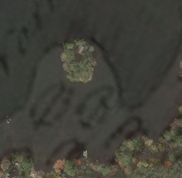
When the 1833 dam was completed, Maspenock was transformed. The owners of the pasture lands and swamp land that lay north of the dam sold the right to flow water over them at any and all times. They did not convey ownership of the land itself, only the privilege of flowing it. Once the dam was completed and the land flooded, some areas remained above the water line as islands, of which the original landowners retained title. Beginning in the 1880s, these islands began to be sold off as camps. Starting with Spindel's Island at the southerly end of the lake by the dam, six islands were created on Lake Maspenock. Only two of these remain actual islands today.Spindle's Island was created from a narrow peninsula that extended in a northerly direction from the far south end of the original pond.
Spindel's Island - Google Earth
In 1833, this area was first flooded, and the high spots created a swampy marsh island. Later, in 1901, when the dam raised the water level seven feet higher, it created the actual island we see today. This piece was one of the many plots of land owned by Justin E. Eames, a farmer and landholder who in 1872 repaired Reservoir Road from a footpath to a road capable of riding a horse and buggy to the lake.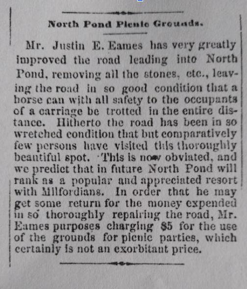
1872 Advertisement for the North Pond Picnic Grounds
He attempted to run picnic grounds in this area, but it is unknown how successful he was at attracting visitors. The first land record that appears for an island on the lake is in 1881 when what we call Spindel's Island was sold by Clarinda Eames, who inherited the land after her father's death. She sold it to a lady named Mary Cheney. It was sold again in 1902 to Bessie Cheney and Nora Adams, who would sell it to Nathaniel and Irene Spindel in 1936. The Spindel family would later live on the island full-time. They voted in Upton, the children attended Upton schools, and Robert Spindel operated a service station in Upton. During the Upton town meeting in March 1961, the townspeople approved an appropriation of $200 to determine the legal boundaries of Upton, Milford, and Hopkinton, where they join each other. The study results showed that Spindel Island was not in Upton but, instead, was located in Hopkinton. This determination caused a conflict as the Spindels believed themselves residents of Upton, and they questioned the validity of the new boundaries. At the next meeting of the Hopkinton Board of Selectmen, the Town Council was directed to transfer the island to Hopkinton on all Town, County, and State records. It was agreed that the four Spindel children would continue to attend Upton schools and that the Town of Hopkinton would pay the tuition. The Spindel family still owns and resides on the island today.Piney Island
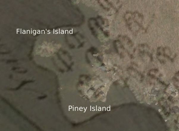
Piney Island - 1831 map superimposed - Google Earth
Piney Island is the southern of two islands created from what is left of the large eastern peninsula of land that took up most of the original eastern shore. The other being 'Flanagans' Island. Initially, this land was owned by the Fiske family, who operated a sawmill in what is now Upton on the Nipmuck Rod and Gun Club site.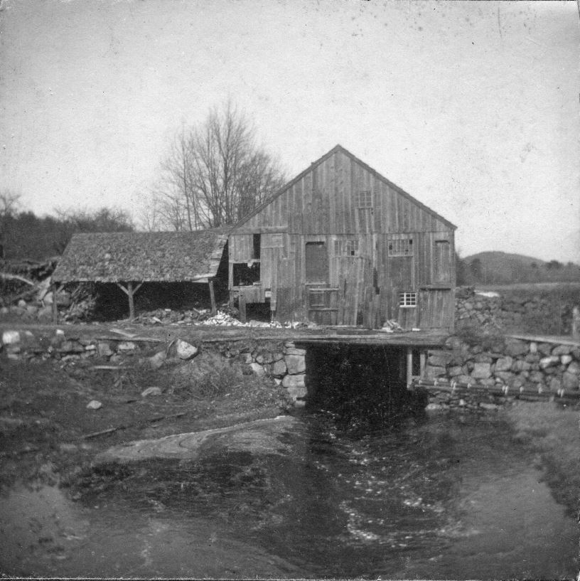
The Old Fisk Mill - Upton Massachusetts
Benjamin Fisk was given flow rights which included land next to the pond which fed his mill pond downstream. His descendant, Clark Fisk, sold a large plot, including all of today's Pine Island Road, to Nathaniel Parkhurst in 1833. Piney Island has two homes now and is no longer an actual island, as it is connected to the shore by a man-made causeway. The road from Milford to the island was once called the Piney Island Cart Path and is now known as Pine Island Road.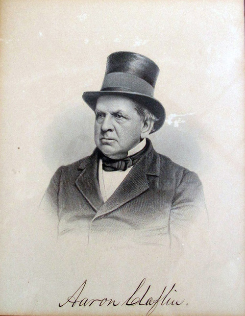
Photograph of Aaron Claflin
Aaron Claflin was born in Milford, Massachusetts, on April 20, 1807. He succeeded his father, John Claflin, in the footwear business. Beginning in 1842, Claflin ran a large and flourishing boot and shoe store in New York City and resided much of his time in Brooklyn. He had purchased several tracts of land around the lake and dam in the 1860s-70s from men named Ball, Wood, Parkhurst, and Eames. In 1901, Charles F. Claflin combined and sold several tracts of land his father had purchased on the eastern shoreline to Andrew T. Macuen. Mr. Macuen had been the proprietor of a cigar and ice cream shop in downtown Milford, but it burned down in 1890.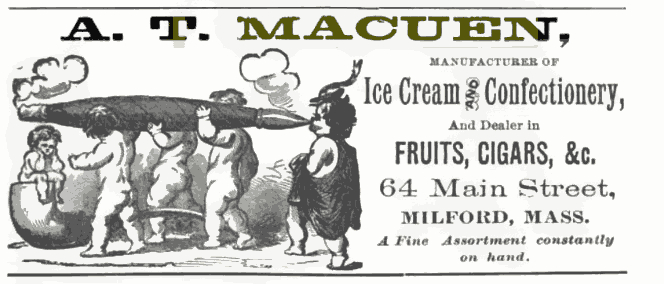
Advertisement for Macuen Ice Cream Shop Milford Massachusetts 1888
The Macuen family also operated a lumber and coal company on Central Street in Milford as well as an ice company. Lake Louisa in Milford was created for ice cutting and owned by the Macuen family. It was named after Louisa Macuen. It is possible that Macuen purchased the land for ice cutting purposes and then sold lots. Andrew Macuen divided several lots from the large piece of land he purchased in 1901 from Aaron Claflin's son, Charles F. Claflin. Charles was one of the founders of the Milford Water Company. Macuen split Piney Island in two and sold two camp lots. The southerly half of the island was sold on August 5th, 1901, only three days after he acquired the larger plot from Claflin. It was sold to Arthur Cheney and five other men from Milford. The northern lot was sold in 1916, with the deed listing John Hickey and six other men, all from Milford, as the purchasers.Flanagan's Island
Flanagan's Island - 1831 Map Superimposed- Google Earth
The second of two islands that were created from the eastern peninsula that once existed is now called Flanagan's Island after a John T. Flanagan who owned the island and ran a small store there in the 1930's.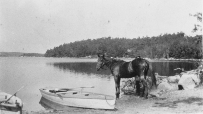
Horse in front of the storage barn for Flanagan's Island Store
Mr. Flanagan also owned a small lot and barn along the shore where he would keep his horses and store items he sold at the store.
Old barn for Flanagan's Island Store - Burned in 2021
This island originally remained the property of Nathaniel Parkhurst after the dam was finished. His daughter would sell it in 1888 to Herman Crosby, Addison Tyler, Emmons Fletcher, Fred Gibson, and Clarence Gordon, all of Milford. Unfortunately for Crosby and his crew, two years later the dam was found to be unsafe and the gates left open for the next 10 years. Flanagan's Island has one house on it but has not been used year round for the last decade. Recently deteriorated electrical cabling has forced the owners to disconnect the island from the grid and work is being done to restore electricity to the island.Sandy Island
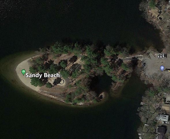
Sandy Island - Hopkinton MA
Sandy Island was one of three islands created from the high spots that stood above the so called Terrible Swamp that was north of the original Maspenock pond. In March of 1927, the Town of Hopkinton voted to take the island by eminent domain. Shortly after this purchase the island was connected to the shore and a parking area installed. Long time resident Earl Cronin has recalled that during the 1920's when Sandy Island was still an island, he would swim from the beach to the island carrying his clothes on his head. In an article written for the Hopkinton Independent, old time resident William Hamilton Jr. wrote about a trip he made to the island in the in the 1920s.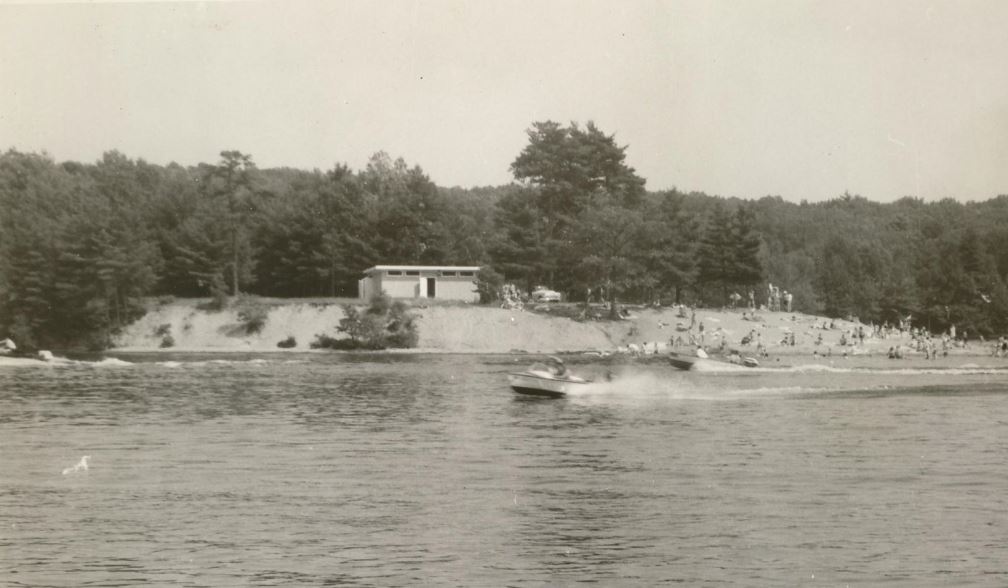
Sandy Beach about 1950 - Photo Courtesy of Deneen/Scarlatta Family
"We walked down Hayward Street to Sandy. We swam until 12:30 p.m. or so. I always got hungry for potato chips when I swam a lot, so we went over to "Max's Cabin", which was located at 141 Hayward Street. It was a small variety store and in the summer on most Saturday nights, they had either a country dance or showed movies on a big screen. So, after potato chips and cakes, we poked around the little pond on Sandy trying to catch frogs. We then continued our swim until about 4 p.m. We walked up Hayward Street and across Downey Street to West Main. I had a little money in my pocket, so we went to First Bridge, where Bridges Grove was located.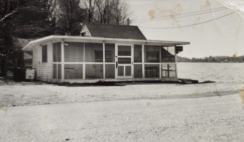
Bridges Grove Clam Shack
Bridges was near where the sewer pump station now is located on the east side of First Bridge. They sold the best fried clams anywhere. We got a small order of clams and fries and enjoyed them. We thumbed a ride back uptown and got home from a totally enjoyable day of swimming at Sandy Island". Today Sandy Beach is open to Hopkinton Residents for swimming. A new restroom building and changing area has been built and residents may also launch boats from the boat ramp located in the parking area.Woody Island - Twin Island
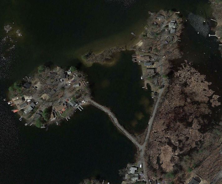
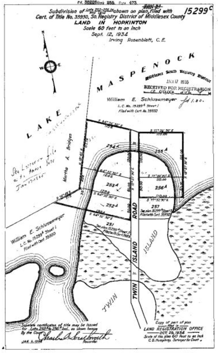
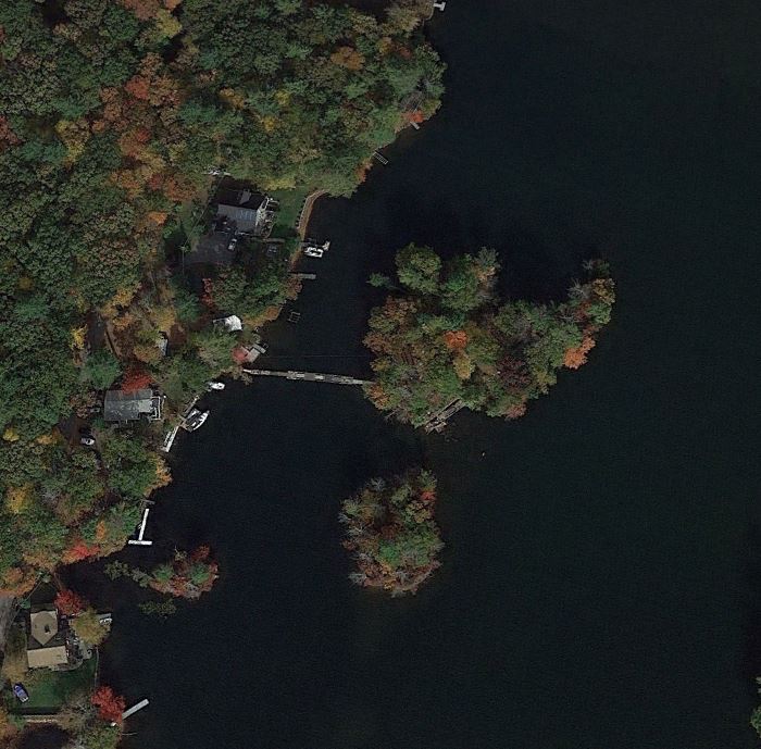
Woody & Twin Islands - Google Earth
Woody Island is the second of the three islands that were created in 1901. All three of the islands in the north basin were part of land owned by a man named William E. Schlusemeyer under the name Lake Shores Realty Company. After the town took his land on Sandy Island in 1928, Schlusemeyer began to develop the two remaining islands under his ownership.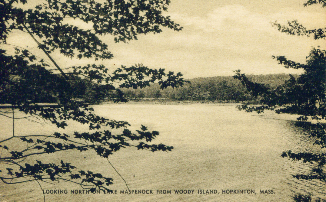
Old Postcard from Woody Island
In 1932 he submitted plans to develop Twin Island and two years later he submitted plans for Woody Island. Both islands were connected to the shore by dirt roads, the lots were then surveyed and sold. He was also involved in the development of the Lakeshore Drive area.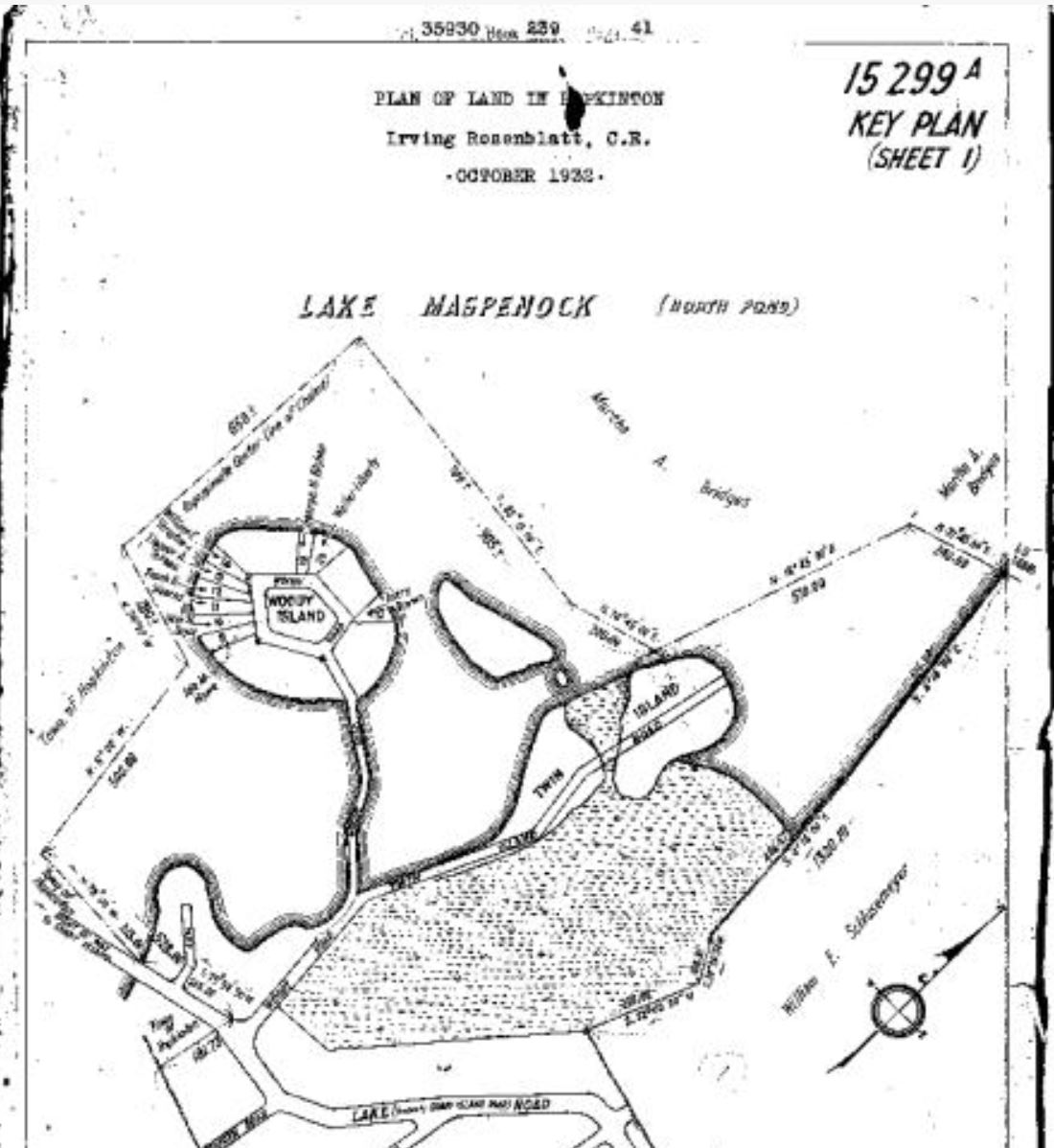
Woody Island Plan 1934