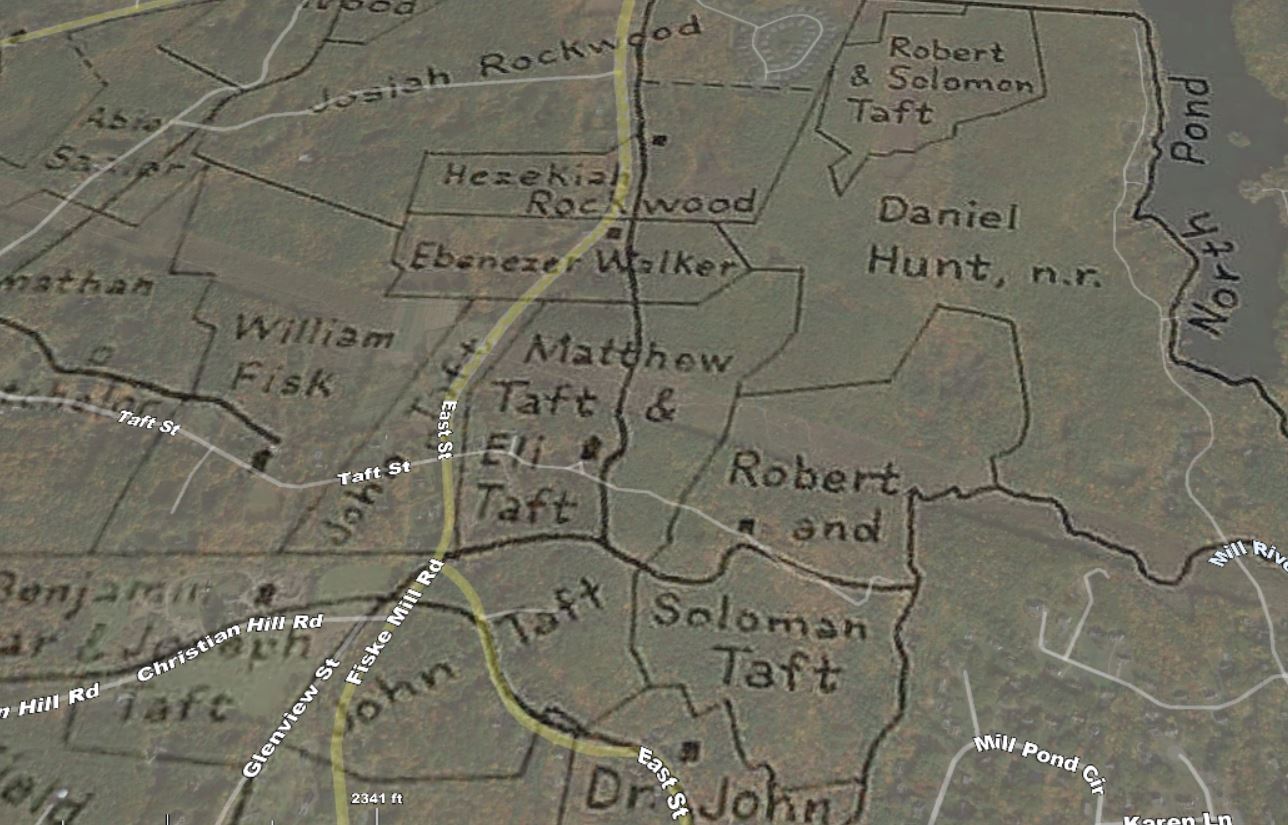
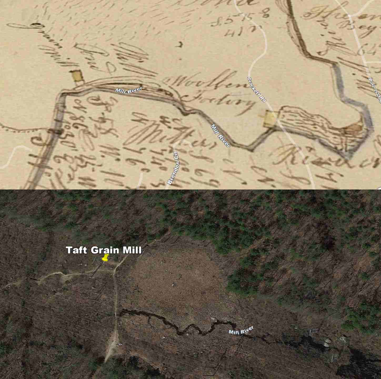
Traveling further southwest on Camp Street, we come to a spot where it crosses the Mill River. At this point, we have entered the Town of Upton, which also has a rich history of early settlement. On the 1794 map of Upton, we can see the land divided among the Taft family in that area. Matthew Taft and his wife Anna Quintain came from Scotland and were among the first to settle in Upton. He was one of the first proprietors of the town. He went to the Lake Maspenock area around 1728, settling in the Peppercorn Hill area and bringing several children. He became one of the most prominent citizens of the town. He was the town moderator in 1741, the Town Treasurer in 1748, and a Selectman in 1739 and 1756. His homestead was in the eastern part of the town around what is now called Taft Street. Matthew and Anna Quintain Taft are recorded as having four children born in Upton. John was born on April 7, 1736. Ann and Matthew Jr., twins, were born on April 27, 1739, and Robert was born on April 27, 1739. Robert was captain of the Upton Company in the Revolutionary War, and Matthew Jr. served under him.The Taft family homesteads can be accessed from Camp Street on the Milford end or Taft Street at the Upton end. What is excellent about hiking this area is that the old cart roads remain much the same as when the Tafts laid them out in the 1730s. An 1831 map shows a mill pond and grain mill located on the property of Robert and Solomon Taft. This is likely the location of Mr. Whitney's mill, which was mentioned in a lawsuit, Whitney v. Eames, 52 Mass. 517, 11 Met. 517 [ https://cite.case.law/mass/52/517/]
Location of Taft Grain Mill - Google Earth
Looking at satellite imagery, you can make out where the old mill pond and mill used to be.
Another thing to note is that the Mill River flows to this area and is joined by a stream from a marshy area on the western side of Peppercorn Hill. Although most of the land on Peppercorn Hill was owned by Daniel Hunt, this odd-shaped marsh area was owned by the Tafts, and it's possible this area also held a dam. When Hunt Wool factory was built upstream on the Mill River, it would have significantly reduced the flow of water to the mill downstream, and it looks like this might have also been a pond used to create an additional head of water for the grain mill.
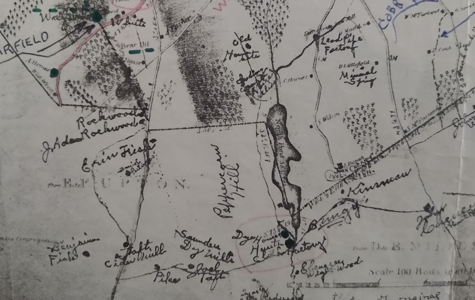
1835 Map of Upton showing Saunders Dye House
A map from 1835 shows that the grain mill had been converted to a dye house to color the linens made in the E.B. Hunt Wool Factory. This map delineated the wool factory, two dye houses, and a cider mill in a small section of the Mill River. It also shows a cider mill on the Taft property to the west.The Taft family was known for their patriotism and service to the country. They had members who fought in major wars such as the American Revolution, French and Indian War, and the Civil War. One of the noteworthy events in the family's history is the story of Lydia Taft. Lydia, daughter of Seth, married Josiah Taft in 1731. In 1756, their son Caleb became ill and died while studying at Harvard, followed by the untimely death of Josiah while in Boston to bury their son.This unfortunate turn of events occurred just before an important vote in Mendon on the town's financial support of the French and Indian War. At that time, only free male property owners were eligible to vote, and Josiah's estate was one of the largest in the town. However, since Josiah was no longer alive to vote, Lydia was given the opportunity to cast her ballot in favor of the appropriation of funds for the war.This event made Lydia Taft the first woman in America to vote!