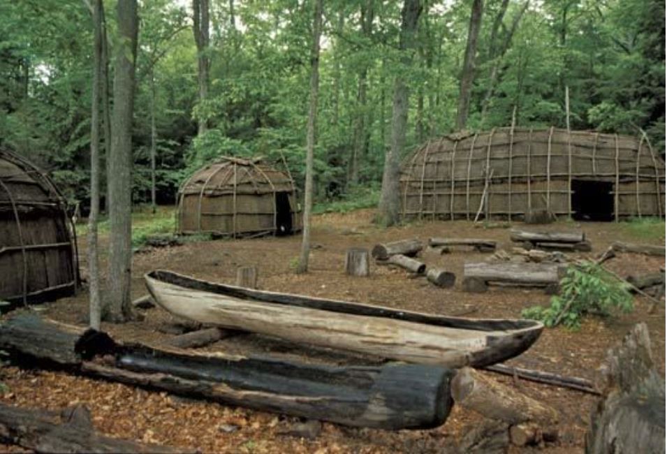
Museum display of a Nipmuck village - Marilyn Angel Wynn/Nativestock Pictures
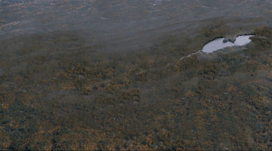
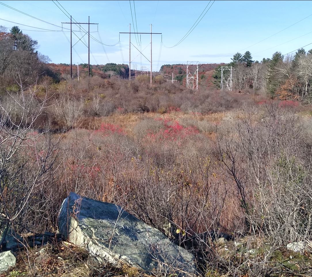
Previous to European settlement, Lake Maspenock was a small body of water in the middle of the wilderness. It was oval in shape with a large peninsula extending from the eastern shoreline. The glaciers that had covered the Maspenock area were slowly receding northward, leaving a landscape that resembled a treeless arctic tundra. The lives of the first people to arrive around Lake Maspenock were closely tied to this environment.
Depiction of Original Maspenock Pond
The majority of Nipmuck sites that have been identified by archaeologists are near bodies of water where an abundance of food and other resources were present.Although I am referring to the original peoples as the Nipmuck, the pre-contact native people were not one tribe or clan.
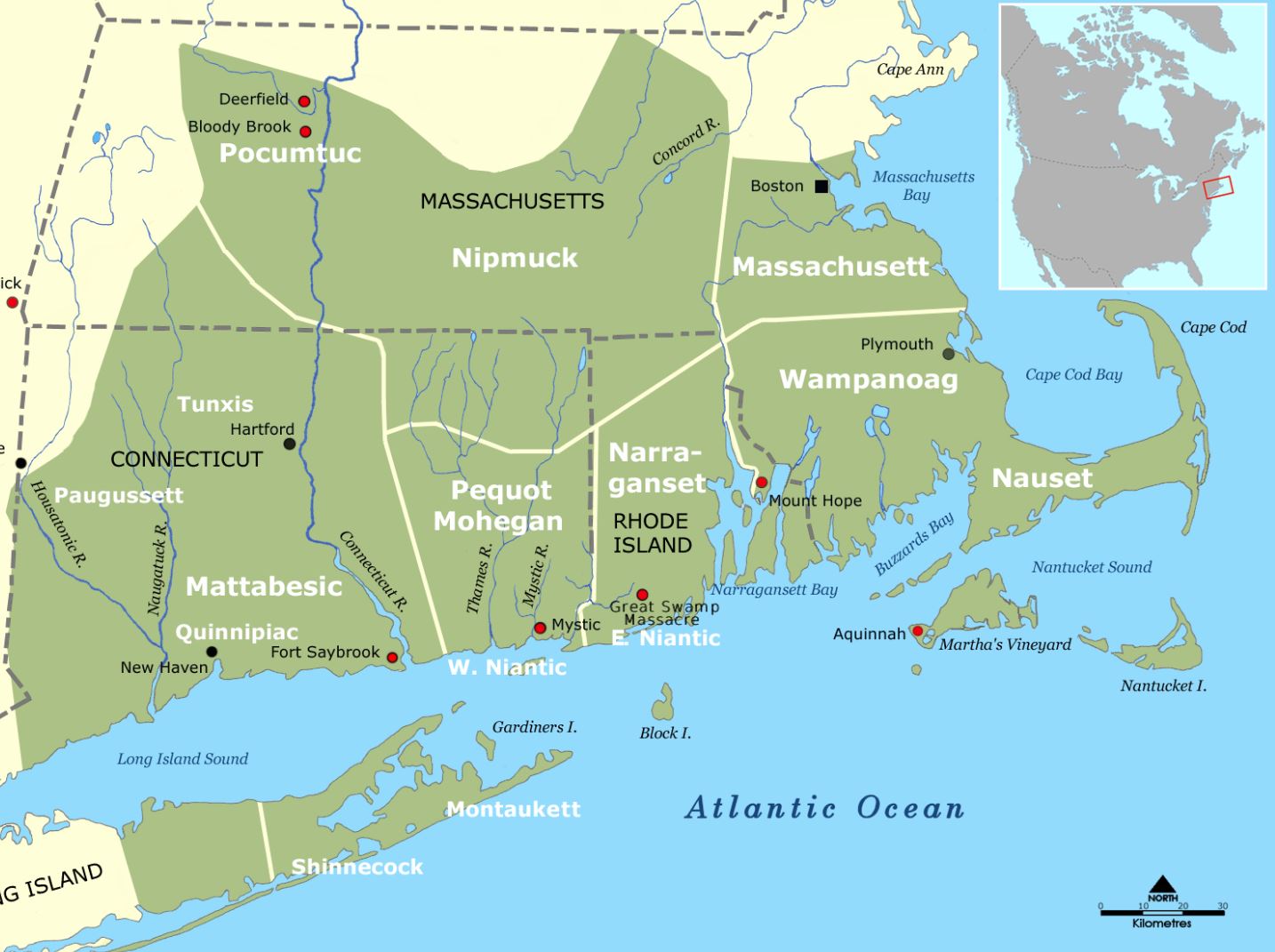
Map of New England Tribal Territories - wikipedia
They were more of a series of families, villages, and small kinship groups that formed complex trade and social networks that stretched from central Massachusetts all the way down into Connecticut. They used well-traveled footpaths and the local waterways as travel routes. They traveled the water with canoes made from hollowed-out logs hewn from the massive cedars that once towered over the area. There is no written documentation of indigenous camp sites on Lake Maspenock. This could be because no real archeological studies have been conducted. The English named the Nipmuck the "Fresh Water People" because of their habit of camping near ponds and streams.The significance of wetlands to the Indigenous people of the area cannot be overstated. These bountiful ecosystems provided them with an abundance of resources such as food, water, medicine and building materials. They considered the wetlands to be like gardens where they could harvest plants for food and medicine. Given this deep connection, it's highly probable that the Nipmuck built their Wetu's and camps nearby in the distant past in order to utilize Maspenock and the Mill River to the fullest potential.In addition to the fish and the marine mammals that live around the water, the native people ate a variety of other animals and waterfowl which were plentiful in the area especially during the spring and fall migrations. Wild plants from both the marshes and dry ground made up a substantial portion of the Nipmuck diet.The Nipmuck themselves named the body of water Maspenock which meant Choice Fishing Place in their native tongue. This tends to prove at the very least they had been using the pond and it had gained a reputation for good fishing. We also know for a fact that the Nipmuck and the Narragansett would strategically place their campsites in the middle of marshes and swamps. This became a key tactic used by the natives during King Philip's War. Setting up camps in swampy, marshy areas had several advantages. In addition to the vast food resources that the swamp landscape offered, it also offered fortification from attack.The high cattails and reeds made the perfect spot to hide a small village of wetu's because they were made of saplings and covered in bark they would have been perfectly camouflaged inside the swampy grasses and bushes.Another reason was that the English found it virtually impossible to use their horses to attack a swamp encampment. The horses would be quickly swallowed up in mud and rendered useless and mud caked firearms were difficult to fire. The only way the English found to defeat a native swamp fortress was to burn the inhabitants out. During the Pequot War, a pre-dawn attack on a massive swamp fortress left over 500 members of the Pequot tribe dead, burned alive or shot as they fled the burning reeds. Adin Ballou's History of Milford tells us Camp Street in Milford is an ancient path that was widened in 1756 but had probably wholly or partly a proprietor's pathway, long prior. This begs the question, why did the very first English settlers of the area name this path Camp Street? Logic would dictate that the path led to camps. The road wasn't called Pond Street or Mill Road or some similar reference. We also know that at the time of the first white settlers arriving, the woodlands were teaming with dangerous animals and it's unlikely to have been referring to settlers camping.
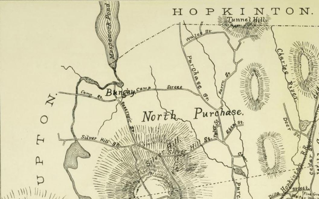
Bungay Shown on 1756 Map of Milford
One very telling clue is the name that the first English settlers gave to the swampy area behind the Lake Maspenock Dam. They named it "Bungay" in the history books and on early maps. According to wikipedia: "The origin of the name Bungay is thought to derive from the Anglo-Saxon title Bunincga-haye, signifying the land belonging to the tribe of Bonna, a Saxon chieftain. Due to its high position, protected by the River Waveney and marshes, the site was in a good defensive position and attracted settlers from early times."
Bungay Swamp
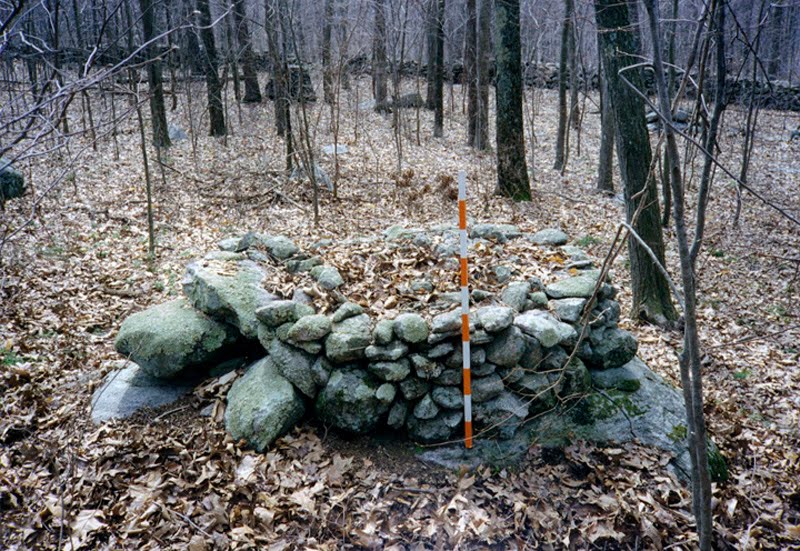
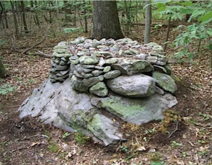
Did the first English settlers find a native encampment in the swamps of Maspenock in the 1670s that reminded them of the swamps back home in England that were used as camps for defensive purposes?It's easy to hypothesize about some sort of native camp located in Bungay on Camp Street but until an archeological study is done we can never really prove it. There is certainly evidence of indigenous life that we can find in the area today which are the stone monuments and structures that are scattered throughout the woodlands all around Lake Maspenock.
These stone constructions and ones like it have been the subject of debate among archaeologists and antiquarians for the past 250 years.According to Doug Harris, the Deputy Tribal Historic Preservation Officer for the Narragansett Indian Tribal Historic Preservation Office:"The forests of New England are dotted with living prayers of stone that were created by the Indigenous peoples of this region"."The traditional belief is that these stone structures were placed to create and restore harmony between human beings and Mother Earth. The prayers they embody continue to live as long as the stones are kept intact."
Dr. Curtiss Hoffman, of Bridgewater State University, is the author of Stone Prayers, in which he shared his findings and insights about these stone structures based on an examination of over 5,000 sites. His extensive research and documentation has led him to the conclusion that most of these stone structures are the result of indigenous ceremonial activity.
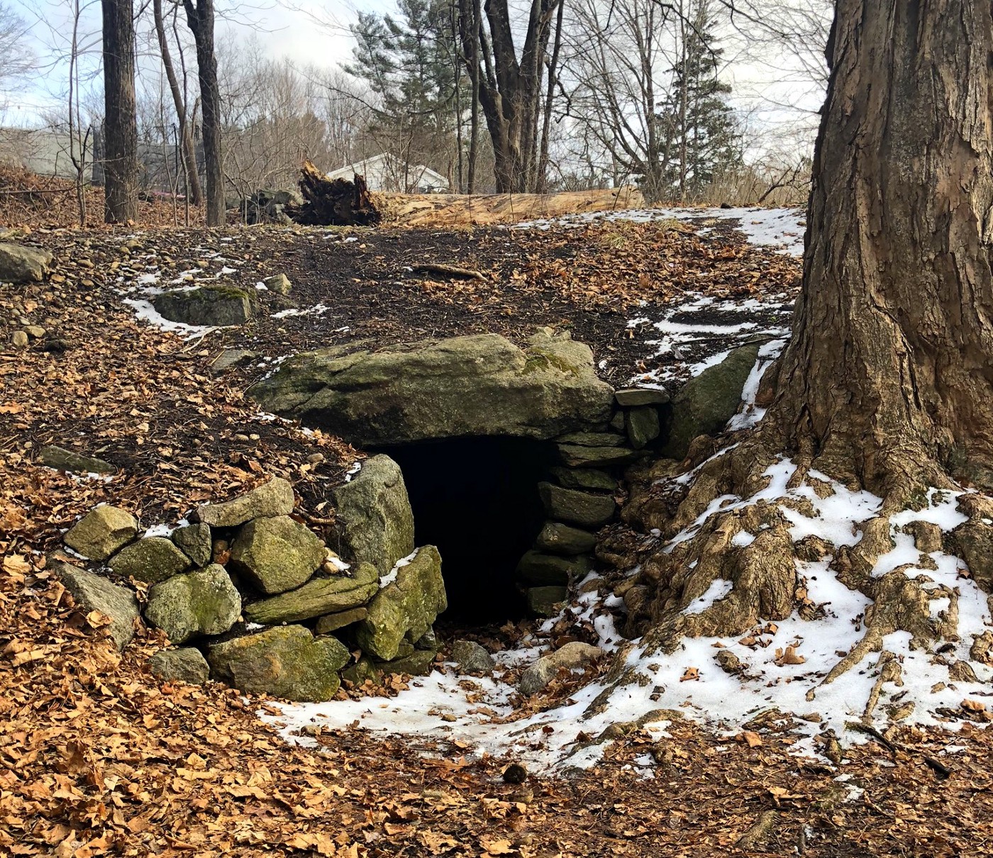
The Upton Chamber - Upton Massachusetts
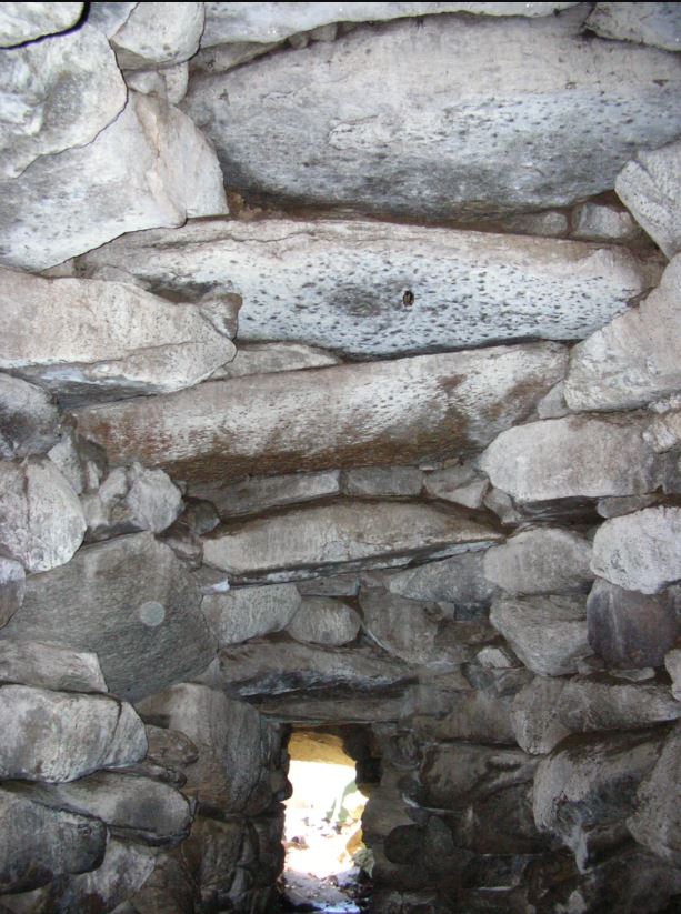
The Upton Chamber is located only a few miles from Maspenock and is suspected to be one of these structures. We can find some evidence of the native usage of these chambers from a detailed account made in a letter written by Roger Williams where in 1643, he described witnessing the use of a chamber:"What the natives call a Pesuponk is a hot house which is a kind of a cell or cave built into the side of a hill that is used for sweat lodge purposes. Into this the men will enter after they have excessively heated it with a pile of wood laid upon a heap of stones in the middle, when they have taken out the fire the stones still keep a great heat". Even though we have early first hand written documentation describing how the indigenous people used these structures, it hasn't stopped other theories from coming forward in recent times. It still seems somewhat unfathomable for modern people to accept that early indigenous people were sophisticated and capable of performing this type of masonry construction for a sweat lodge.
Interior view of The Upton Chamber looking out
With a 14-foot entrance tunnel and a dome that rises about 12 feet and topped by a large capstone, it's one of the largest beehive chambers in New England. The chamber was first featured in William Goodwin's 1946 book, The Ruins of Great Ireland in New England, where he proposed that early Irish explorers built the chamber due to its similarities to those built in Ireland in antiquity.More pioneering work was done by authors James W. Mavor, Jr. and Byron E. Dix. Their 1989 book entitled Manitou, The Sacred Landscape of New England's Native Civilization , hypothesized that the chamber was used as an astronomical observatory between 700-750 AD.
In 2011, the entrance to the chamber was restored by master stonemasons David Stewart-Smith and David Wiggins. As part of this restoration project, archaeologists from John Milner and Associates conducted an archaeological investigation where soil samples were taken for O.S.L. dating. The results were an average age of 523 years and a date range for the construction of the Upton Chamber to be 1350 to 1625 A.D.
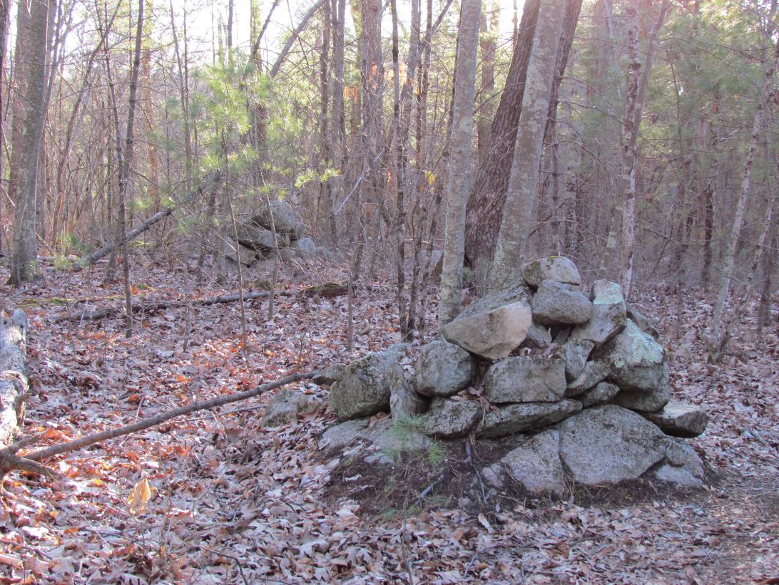
Native Stone Pile-Taft Street Ext. near Peppercorn Hill
There also are several accounts documented by the early local settlers on the custom of the natives for piling stones on top of stones in special places or what we call stone cairns today. When asked, in most cases the native people obfuscated the meaning of the piles because they had learned that the English people, and especially the Puritan religious figures, were very intolerant of their native beliefs and therefore would not allow these things to exist because they considered it to be the devil's work.When asked about the purpose of the stones, the natives would reply with answers such as "My father always told me to do this" or "It's our custom". In this way, they were trying to protect these objects by claiming not to know what they were used for or to disclose the true meaning of the objects. Those people that did answer truthfully told of it being what we might call a superstition. They had been taught by their ancestors if they did not cast a stone or piece of wood on the bigger stone they would not prosper and particularly would not be lucky in hunting deer.In 1616, devastating diseases that were carried by European fishermen and traders swept down from the Maine and killed 90 percent of the local indigenous population.The settlers arriving here saw this apocalypse as the work of their God, clearing the heathens away so they could supplant them and tame the wilderness. The only problem was the Nipmuck people had not been entirely wiped out and the remaining clans were being encroached on from every direction by English settlers. The settlers used various methods to "legally" take the natives' land. At first, the settlers had been accustomed to allowing their cattle to roam and forage. They roamed so far as to destroy the crops the women had planted in the places their ancestors had planted for centuries. When the natives complained they were told to fence in their fields to keep the settler's animals out. This forced the Nipmuck to confine their spaces with fencing which allowed the unfenced lands to be seen as unowned and free to be claimed by settlers. They also regularly sold trade items, firearms, and alcohol to the native people. Once indebted, the settlers could force the sale of land as repayment. We even have records from the time that one of the first settlers in Upton, Robert Taft, was in trouble with the law for selling alcohol and firearms to the Nipmuck.Slowly but surely the indigenous people's lives of abundance was being destroyed. No longer able to hunt wild game or keep good land to grow their crops, they sustained themselves on horse meat, small animals, ground nuts, acorns, and berries.No longer the proud, self-sufficient people their parents and grandparents were, the native people of the area were pushed into a hard choice, either assimilate with the colonists in a Praying Village or fight to keep what was left of their land and lifestyle. One such Praying Village named Magunkaquog, would eventually become the Town of Hopkinton.When King Philip's War broke out, many "Praying Indian" leaders wanted to remain neutral in the conflict. Unfortunately some of the "Praying Indians" eventually joined with Philip and the resulting conflict cast a long dark shadow across New England, straining relations between Native peoples and settlers beyond reconciliation.The Nipmuck people are still with us today. Their reservation is located on the site of one of Eliot's Praying Villages. The Hassanamesit Reservation, a 3.5 acre plot in Grafton Massachusetts, is the smallest American Indian reservation in the nation and remains the property of the Nipmuck people.. It is the sacred mission of all the members of their community to preserve and promote the culture, language, and values of the Nipmuck People, while striving to improve the quality of life for all their citizens, including the generations to come. With nearly 600 members, they continue to be one of New England's most historic and largest native communities.You can learn more about the Nipmuck people and their history from the Nipmuck Nation Website