The Complete History of Lake Maspenock
Lake Maspenock - Original Cart Roads
When the first English settlers arrived in the wilderness surrounding Lake Maspenock there were already well traveled pathways that existed from centuries of foot traffic by the indigenous Nipmuck clans that lived in the area. There were also well established crop fields that had been used seasonally by the Nipmuck. Deadly epidemics resulting from encounters with the early white explorers ravaged the Nipmuck population. Later, when the English began to settle this area, they took the abandoned roads and fields as a sign from their God that they were meant to supplant the Nipmuck as the rightful inhabitants of the land. Instead of hacking through the ancient forests, they reused some of these existing paths. At first only a man on horseback would able to pass on the narrow footpaths. When the towns started to become settled, they widened and straitened these paths in order for a ox and wagon to fit. According to TeachUsHistory.com, each New England town was responsible for building and maintaining all roads within its limits. Town laws originally required adult males to work a certain number of days each year on the roads with few exceptions. Although conditions varied somewhat from town to town, indifference usually prevented significant improvements.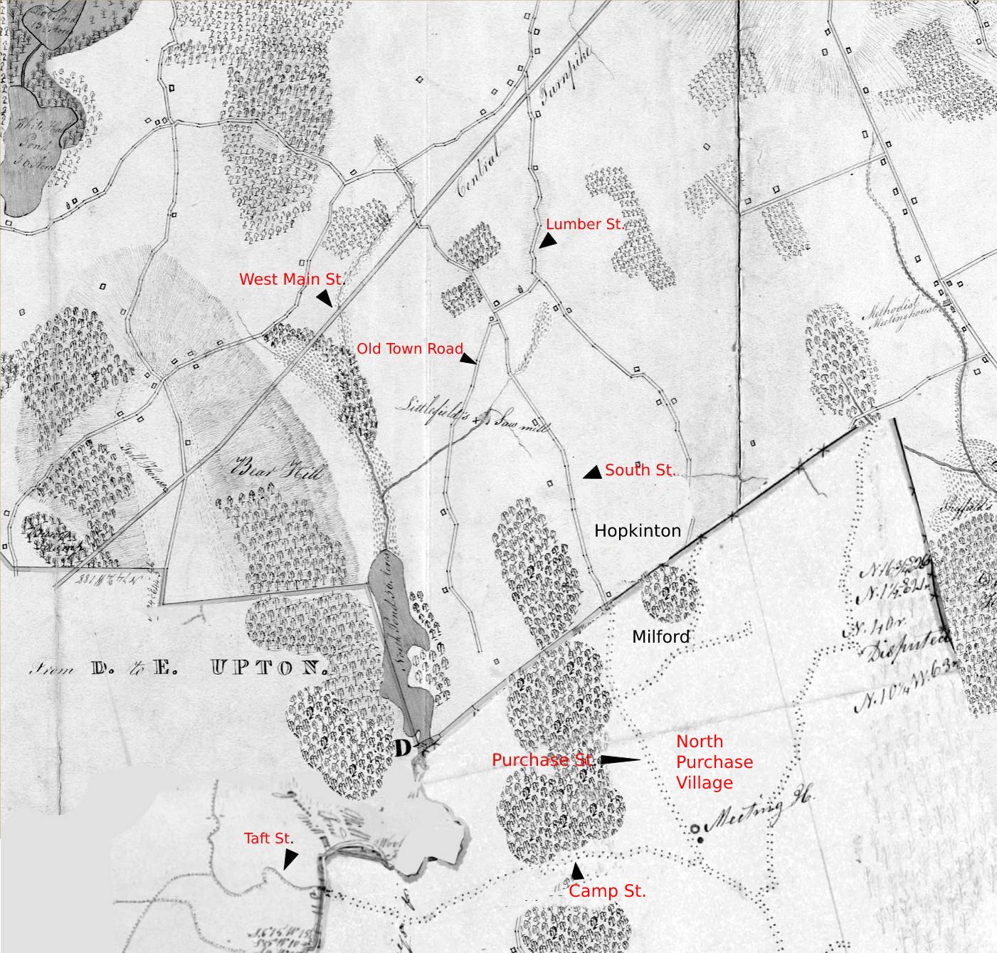
Map of original roads around Lake Maspenock
Labor on the roads was supervised by surveyors of highways, who were elected annually by the towns. When John Adams reached the age of twenty-one, he was surprised to find himself nominated for this job and objected that he knew nothing about road making. He was told that "they make it a rule to compel every man to serve either as Constable or Surveyor, or to pay a fine." Adams performed his duties in a conscientious way, even though a bridge built under his direction soon was washed away. It seems that most highway surveyors lacked interest as well as skill and that many of them were concerned only to have the roads past their own houses repaired.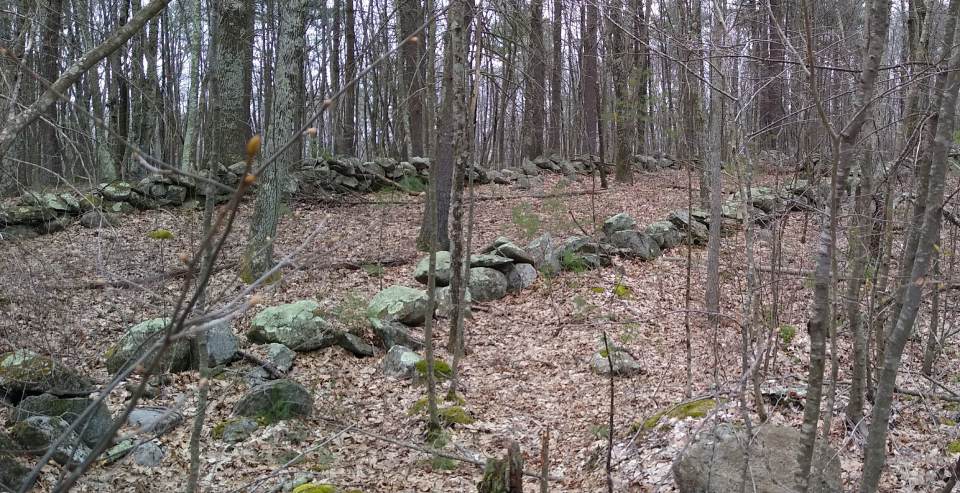
Remaining section of Old Town Road
Gangs of men working out their own or someone else's highway taxes remained a common sight in many New England towns until well after the Civil War. Some work was done during the fall and the roads had to be cleared after particularly heavy snowstorms, but most repair work was done on several days in June during the period between planting and haying. The roads then were deeply rutted but were no longer muddy from spring thaws and rains. Gutters were ploughed out and ruts filled with the dirt and decayed vegetation. In many instances the dirt simply was piled high and left to be worn down by the wheels of passing vehicles, although ox-drawn scrapers sometimes were used to level and smooth the road surface. Much time was spent in leaning on shovels or hoes or resting in the shade, many day on the roads was widely regarded as a holiday from farm work. Rum flowed freely, stories were told, and impromptu footraces and contests of strength occasionally were held. At the end of the day the workers were given credit for a day's labor and left the roads in little better condition than they had found them. The Central Turnpike, now West Main Street (rt.135), was a private toll road in Massachusetts that was chartered by the Massachusetts State Legislature on June 12, 1824. The route began in Wellesley heading west to Dudley, where it continued into Connecticut as the Center Turnpike. Lumber Street ran from the Central Turnpike to the North Purchase Village in Milford. The intersection of Lumber Street and the Central Turnpike was known as Claflinville, after the Claflin family who settled in the area. A man named Adams also lived along Lumber Street in those early years. Hayward Street originally only ran from Lumber Street to South Street. This road was cut in two when Rt. 495 was built and later the western end extended down to Lakeshore Drive. The Hopkinton #8 School House once stood where the middle of 495 is today. A small one room schoolhouse once stood where Route 495 is now. In 1887 the teacher was named Lilly Smith and she made $369 that year. There were 19 students in the school from 8 families. South Street also connected to the Central Turnpike and ran south until it met the town line in Milford where it becomes Purchase Street.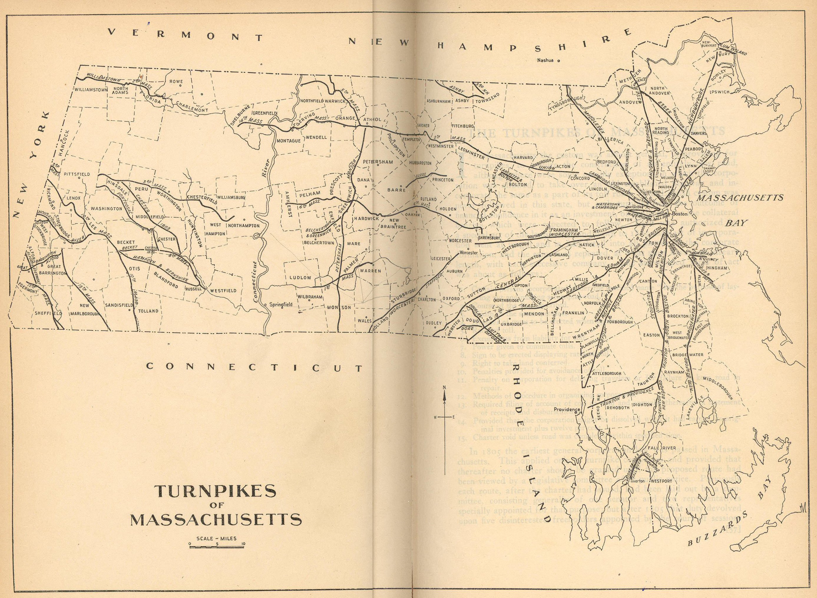
Map of Old Town Road running through leased land of J. Gordon
Old Town Road, is an ancient cart path dating all the way back to Hopkinton's origins as leased lands owned by Harvard University. Hopkinton was named for Edward Hopkins who left a legacy to Harvard College. The trustees of Harvard purchased land from the Indians and proceeded to lease it out at three pence an acre. They found the taxes ate up the rent and lowered the rent to one pence per acre but asked the tenants to pay the taxes. The land was purchased from the Trustees and the rent system discontinued in 1832. Old Town Road runs through a one hundred acre parcel that was leased from Harvard by a man named J. Gordon.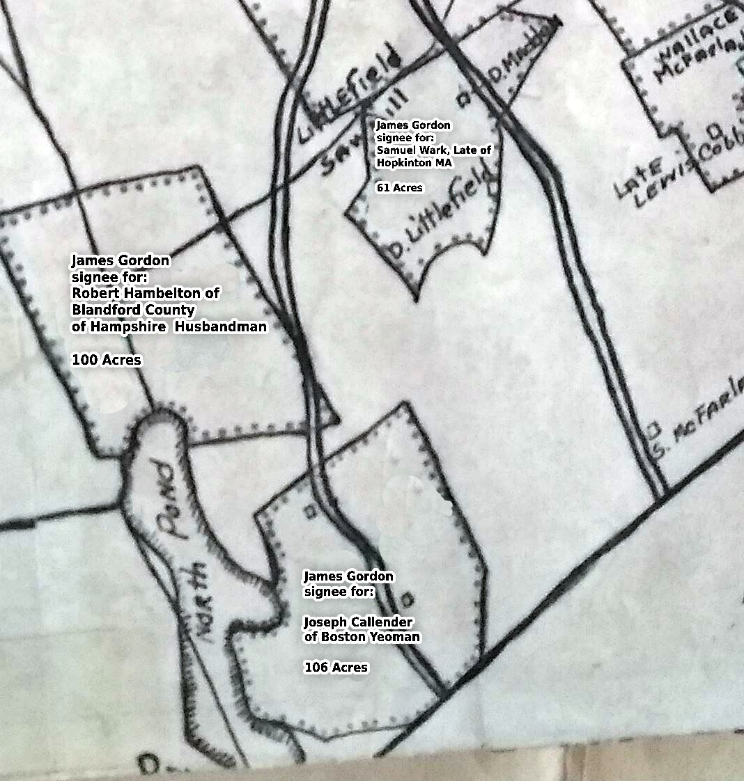
Map showing original tenant plots and acreage.
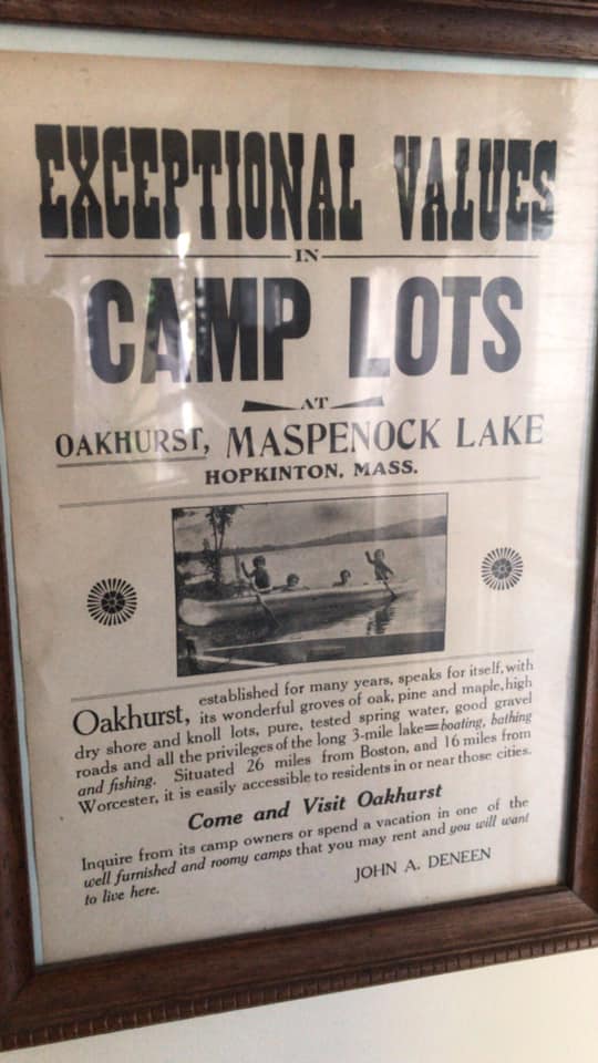
Today, only a tiny portion of Old Town Road still exists. Old Town Road ran south to the town line in Milford, passing a saw mill and three farms along the way. In the 1750s, the Nelson family would own and farm the lands on Old Town Road. Camp Street was laid out by the Taft Family who originally settled at the western end. It was widened and improved by the Town of Milford in 1754, and the westerly portion widened 2 rods wide in 1813. The first village near the lake was settled in the area of Camp and Purchase Streets in Milford. It was called the North Purchase Village and there was once a Meeting House, Church, School, and Bowling Alley in the village. Camp Street runs westerly from Purchase until it becomes Taft Street in Upton at the Mill River. In 1760 a man named Joseph Cody from Hopkinton built a homestead on Camp Street near Pine Island Road. Pine Island Road On old road, originally unnamed and known as the road to North Pond this road was greatly improved in 1872 by a man named Justin Eames who built the Milford Picnic Grounds near the Maspenock Dam to attract visitors to the area.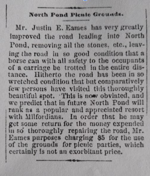
1872 Article on Justin Eames and Milford Picnic Grounds
In 1917, the North Pond Terrace development was established bringing many small lake cottages to the street. The Milford Picnic Grounds, started by Justin Eames, was left in place as a small park and boat launch for Milford residents to enjoy.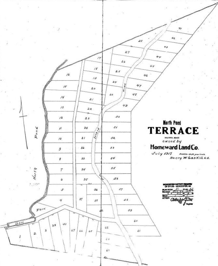
Plan of North Pond Terrace, Milford, Massachusetts 1917
Once Pine Island Road crosses the town line in Hopkinton, the road was once known as the Piney Island Cart Path, where in the beginning of the 1900s hunting and fishing camps were established. Pine Island Road in Hopkinton remains a private road owned by deeded right to the original camp lots.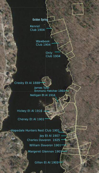
Original Camps - Pine Island Road, Hopkinton,Massachusetts
The Piney Island Cart Road
In 1833 Clark Fisk sold a large tract of land to John Parkhurst. The Fisk family owned a mill where the Nipmuck Rod and Gun club stands today and since Lake Maspenock feeds that mill it is believed he owned the original land and water rights to the pond. This land included what is now Pine Island Road and Piney Island when it was part of a peninsula.
Mr. Parkhurst later sold most of this land to Aaron Claflin when he was buying up land to be flooded by the higher dam. When the lake was raised, all that was left of the eastern peninsula of land the Parkhurst family owned was now an small island.
The new Piney Island remained the property of the Parkhurst family until 1849 when Lucy Parkhurst and others sold the island land to Justin Eames. Aaron Claflin acquired it from Aemes sometime between 1849 and 1888 at which time he sold it to the men who would build the very first clubhouse on the lake. In 1888, Herman Crosby, Addison Tyler, Emmons Fletcher, Fred Gibson, and Clarence Gordon, all of Milford, became the owners of the first club camp on Lake Maspenock. It was located on Piney Island.
Taft Street Taft Street is the western extension of Camp Street in Milford. Once the road crosses the Mill River it becomes Upton land and Taft Street. Taft Street is named after the Taft family who settled and farmed the area in the early 1700s. Robert Taft's homestead and shop can be found along the road as well as the farms of his sons and grandsons.
Lakeshore Drive was developed beginning in 1933.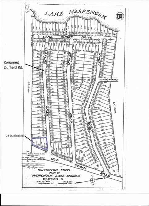
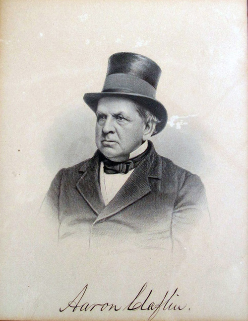
Photograph of Aaron Claflin
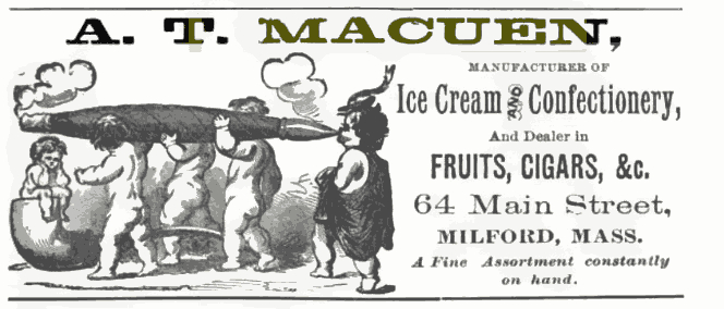
Aaron Claflin Aaron Claflin was a wealthy boot and shoe manufacturer originally from Milford, who had moved to New York to operate his dry goods business. He had purchased several tracts of land around the lake and dam in the 1860-70s from men with the names Ball, Wood, Parkhurst and Eames. As a matter of fact upon his death his obituary mentioned that he was the largest land owner in Milford. The Milford Water Company was incorporated in 1881 with a capital stock not to exceed $100,000 by Moses Joy Jr., Charles W. Shippee, John P. Daniels, Ephraim L. Wires, and Charles F. Claflin, "for the purpose of furnishing the inhabitants of Milford with pure water for the extinguishment of fires, and for domestic and other purposes." Once the dam was completed, the remaining land that had not been flooded by the lake became available for sale. In 1901, Charles F Claflin, Aaron's son, combined and sold several tracts of land that his father had purchased around the dam to a man named Andrew T Macuen. Mr. Macuen had previously been the proprietor of a cigar and ice cream shop in downtown Milford.Advertisement for Macuen Ice Cream Store 1870s
As it turns out Mr. Macuen's shop burned down in 1890 and ten years later it looks like he was in the real estate business. Immediately after purchasing the land from Charles Claflin in 1901, Macuen began sub-dividing lots and selling them. Almost all were sold to groups of men from Milford who cleared the lots and built small fishing and hunting clubs.Original Camp Locations and Year-Pine Island Road
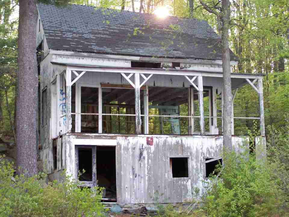
By the 1920's these camps dotted the eastern shoreline of the lake. On Pine Island Road and extending north were clubs called Hopedale Hunters Rest Club, Camp Joy, The Wawbeek Club, The Kennel Club and The Only Club and other clubs owned by multiple men who's club names were not recorded on the deeds.Remains of Wawbeek Club about 2003
Remains of The Wawbeek Club 2001
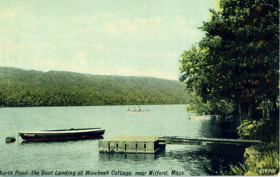
Post Card- Wawbeek Cottage 1911
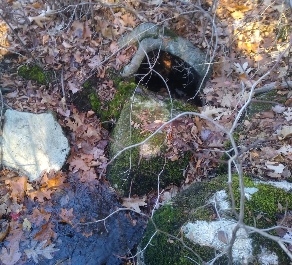
Geri Rogers writes about the trip on the cart road in her memoir, "North Pond Memories" "The dirt road that leads to the pond kept all but the worthy at bay. A car, attempting to pass the test, bumped cautiously along in a vain effort to avoid the boulders left by retreating glaciers. The road was barely passable by horse-drawn cart, much less an automobile. All along its dusty way, woods hid any sight of the pond, until, at a sudden turning, sparkling blue waters leapt into view behind a curtain of shimmering leaves. This first sight of the water always caused a tingling sensation in the pit of my stomach and filled me with awe". The deeds for these lots still hold a right of way to Pine Island Road and every deed holder on Pine Island Road still has a right of way to the spring behind the old Kennel Club which was once called "Golden Spring". The deed specifies they can "take water from the spring by dipping with pails or glasses but not otherwise". This clause in the deeds goes all the way back to Andrew Macuen in 1901 as at that time there were no wells for these camps. Geri Rogers recalls the stream in her memoir as follows: "A boat carried us diagonally across the lake to the bubbling spring where we scooped our buckets of drinking water. The spring was a refrigerator for those lucky ones who lived near it. Soft drinks and milk bottles sat cooling in the little cold stream that trickled from the spring into the lake. I was frequently elected to fetch the spring water. My mother feared boats, and for many years after I had become expert at rowing and swimming, she insisted that I row along the shore for this trip. I still recall the exhilarating experience of rowing, by myself, across the deep water to the spring."
The "Golden Spring" was once the only source of water for the camps of Piney Island Cart Path
The fishing and hunting clubs fell out of favor and taxes were not getting paid to the town. By the 1940's, deeds for Lakeshore Drive had stipulations that "under no circumstances is this property to be used for the purpose of occupancy of any social, fraternal or other organization, club or association." The old fishing shacks have rotted into the ground or have met the wrecking ball. Some were expanded upon and turned into year round homes.Taft Street Taft Street is the western extension of Camp Street in Milford. Once the road crosses the Mill River it becomes Upton land and Taft Street. Taft Street is named after the Taft family who settled and farmed the area in the early 1700s. Robert Taft's homestead and shop can be found along the road as well as the farms of his sons and grandsons.
Lakeshore Drive was developed beginning in 1933.